
|
|
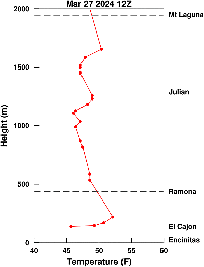
Meteorological Data for Mar 27 2024 (from 12Z Miramar Sounding):
Inversion Base Height = 137 meters
Region Above Inversion:
Windspeed = 2.1 meters per second
Region Near Surface (lowest 50mb):
Windspeed = 1.3 meters per second
Predicted Morning Marine Layer Cloud for San Diego |
|
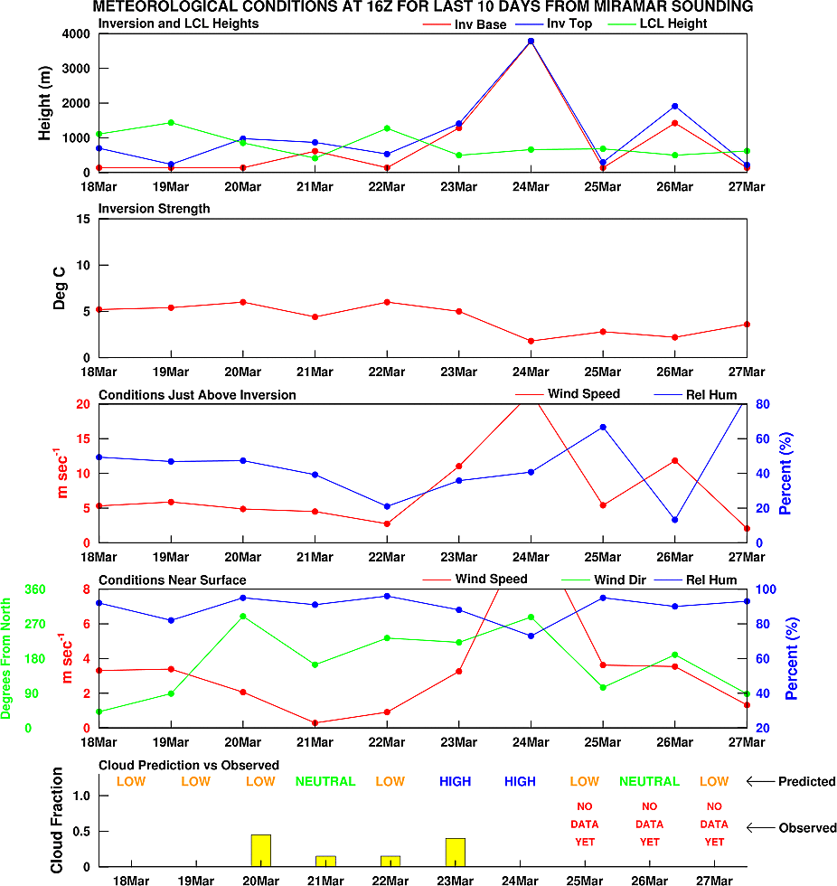
The above prediction was based on a multiple linear regression. The regression predicts the amount of low clouds (bases less than 5000 ft) at San Diego Lindbergh Field during the morning hours (8am to Noon). The regression uses various meteorologcial quantities, including some shown above, as predictors. The regression was developed using daily data from the 12Z Miramar sounding from 1980-1999 during the months of May and June.
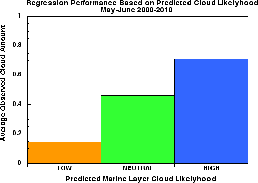
2000-2010 Period
The prediction scheme was tested using data from May and June 2000-2010.
While certainly not perfect, the algorithm does show some skill in predicting
the amount of morning clouds with a correlation of R=0.62.
It is probably better to use the predictions in a qualitative sense using broad classifications of cloud likelihood such as low, neutral (moderate), and high. A low likelihood is assigned if the regression predicts a cloud cover of less than 40% (0.4), while a high likelihood is assigned if a cloud cover of greater than 60% (0.6) is predicted. A neutral likelihood is assigned for predicted cloud cover between 40 and 60%.
The plot below shows the averaged observed cloud amount at San Diego Lindbergh Field for each of the three predicted cloud likelihood classifications. Again, the regression technique does show some skill as those days that were classified having a high likelihood of marine layer clouds had a significantly higher observed cloud amount than those days classified as either neutral or low likelihood.
This is a very simplified prediction that utilizes meteorological data at only one location (Miramar). It is likely that the skill would be improved by incorporating data at additional locations in the region, both on land and over the local offshore waters and is the subject of future work.