|
|
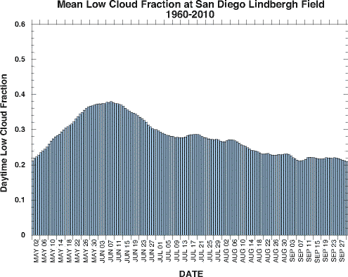
Within the May-August time frame, the occurrence of marine layer clouds along the coastal areas reaches a maximum during early June then gradually decreases throughout the summer. The figure below shows the fractional amount of time low (cloud base less than 2500 ft) clouds were present during daylight hours at San Diego Lindbergh Field.
 Why are marine layer clouds more prevelant over coastal regions during the summer months? The main reason is that
the Pacific High pressure system is strongest during these months. The subsiding air within the Pacific High helps
form the stable inversion layer that allows these marine layer clouds to form.
Why are marine layer clouds more prevelant over coastal regions during the summer months? The main reason is that
the Pacific High pressure system is strongest during these months. The subsiding air within the Pacific High helps
form the stable inversion layer that allows these marine layer clouds to form.
The Pacific High usually reaches its maximum intensity around July. This leads to the question is why do May and June have higher marine layer cloud amounts than July and August? There appear to be a few reasons for this. First, the winds that bring the marine layer clouds onto the land regions are strongest and most persistent during May and June. Another factor is that the Sea Surface Temperature (SST) off the Southern California coast is considerably cooler during May and June compared to July and August.
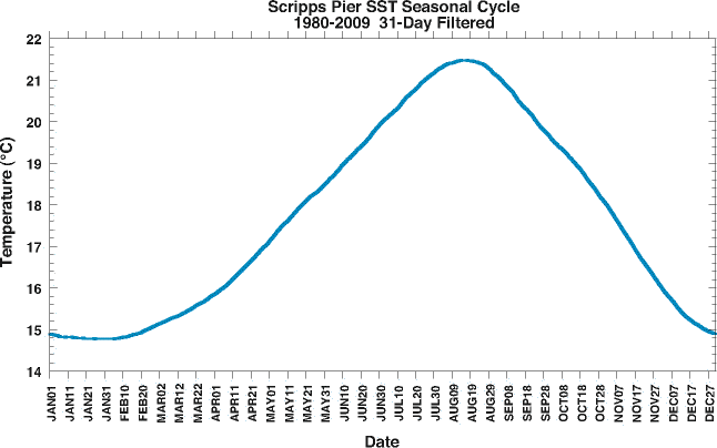
The colder SSTs increase the inversion strength making it easier for marine layer clouds to form. The sea-breeze circulation is also enhanced by the colder SSTs which allows more onshore winds to transport the clouds onto the land areas.
A third reason for maximum marine layer clouds during May-June is that during these months the clouds tend to be the thickest and the thicker the cloud the longer it takes to dissipate during the day.
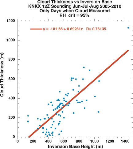
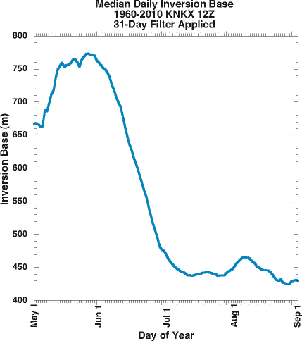
The plot above shows the relationship between inversion base height and the thickness of marine layer clouds for individual days during June-August 2005-2010. Thicker clouds are clearly associated with higher inversion base heights. The plot below shows the median daily inversion base height at Miramar Naval Air Station for May through August. The highest inversions, and hence the thickest marine layer clouds, occur in late May and early June which corresponds to the times of maximum daytime cloud coverage.
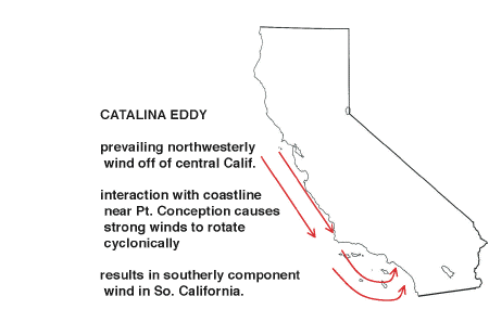
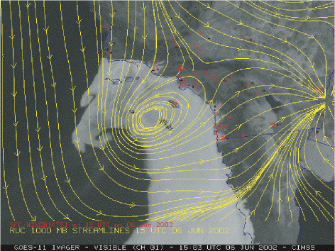
An interesting feature of the local Southern California climate is what's known as the Catalina Eddy.