
|
|
Instruments on the GOES satellites measure radiances in 5 wavelength channels (1 visible and 4 infrared) which differ slightly from those used in the original CERES cloud mask. As a result, minor modifications to some of the coeffiecients in the algorithm were made by calibrating the cloud mask results to surface based observations of cloud cover.
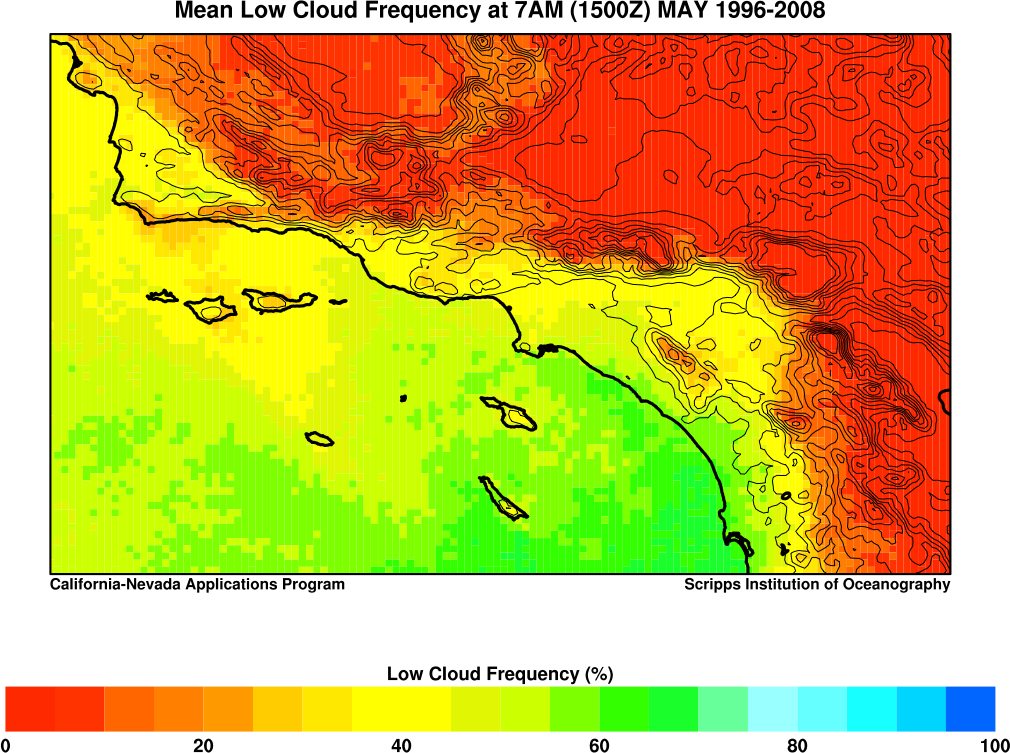
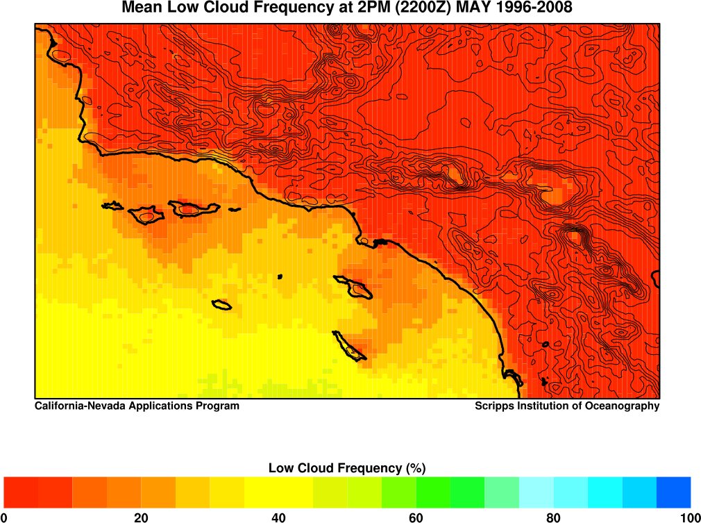
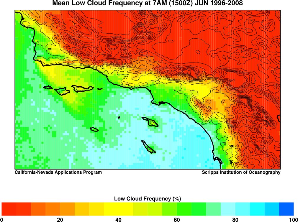
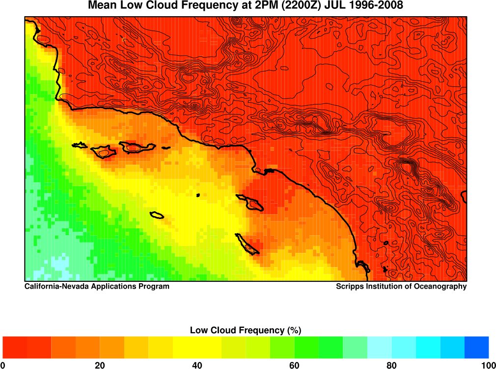
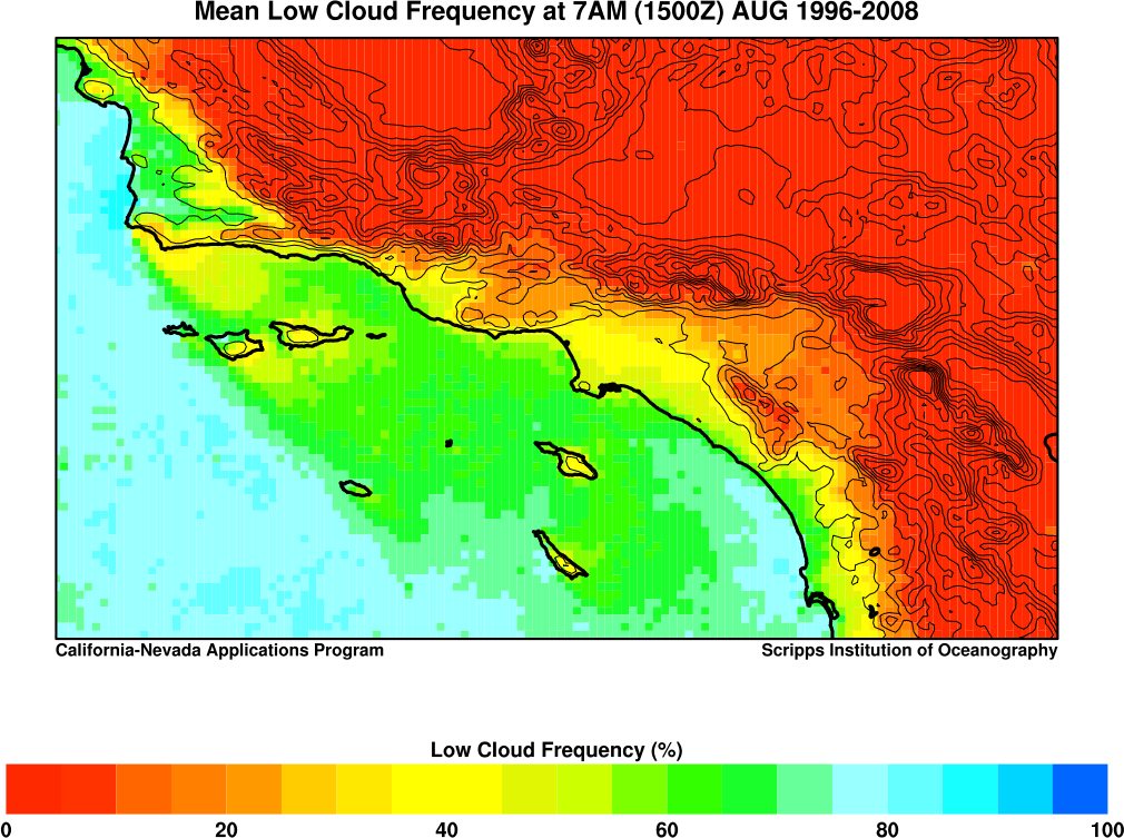
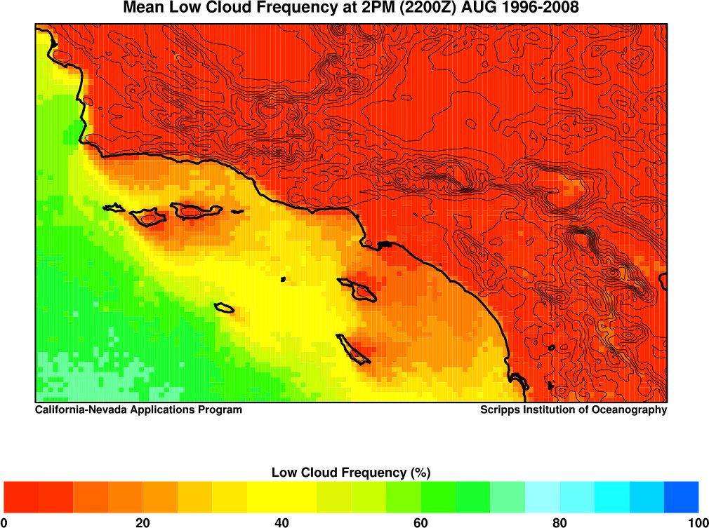
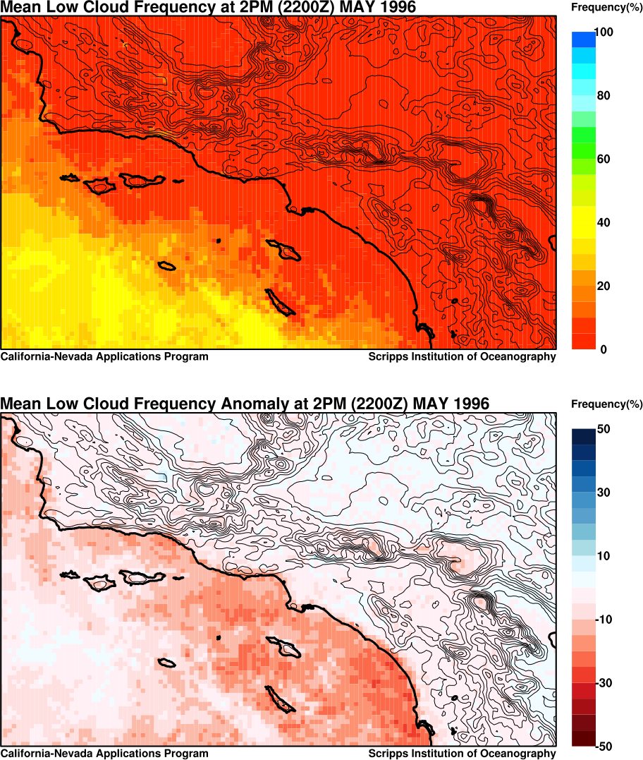
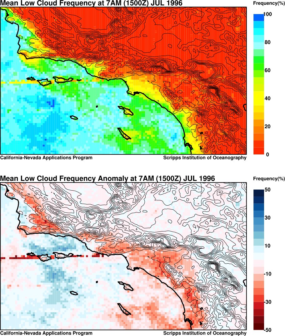
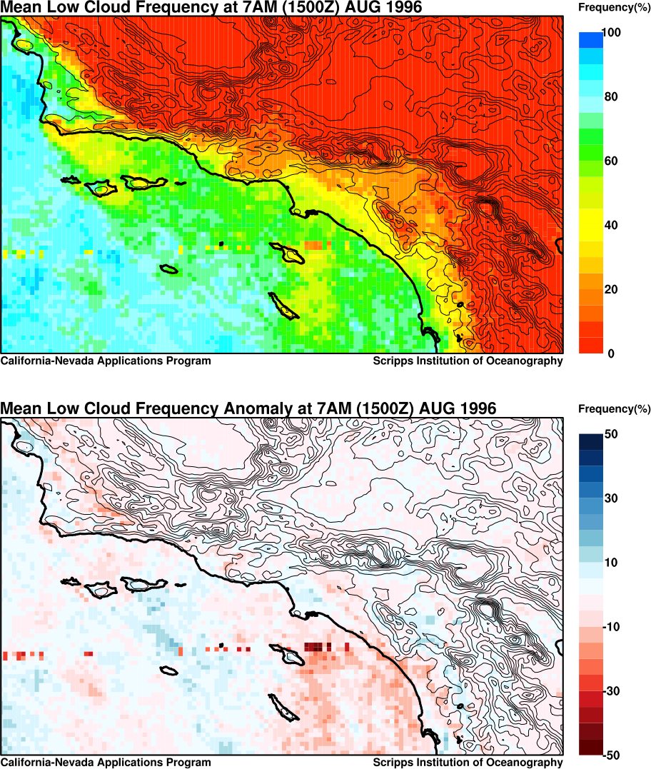
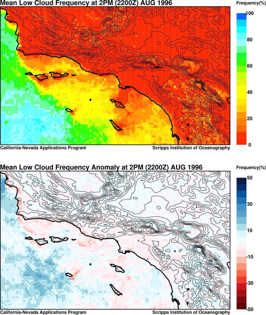
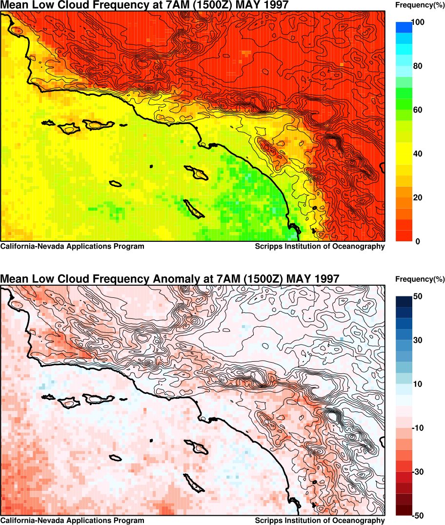
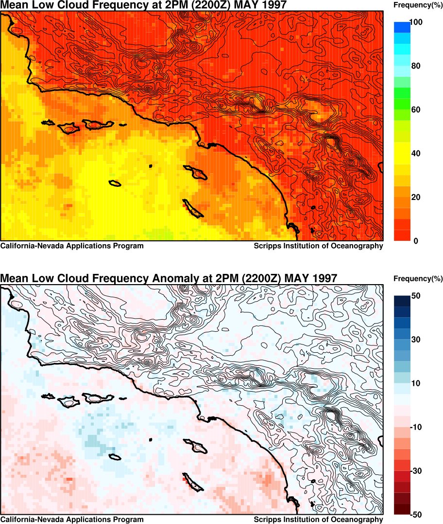
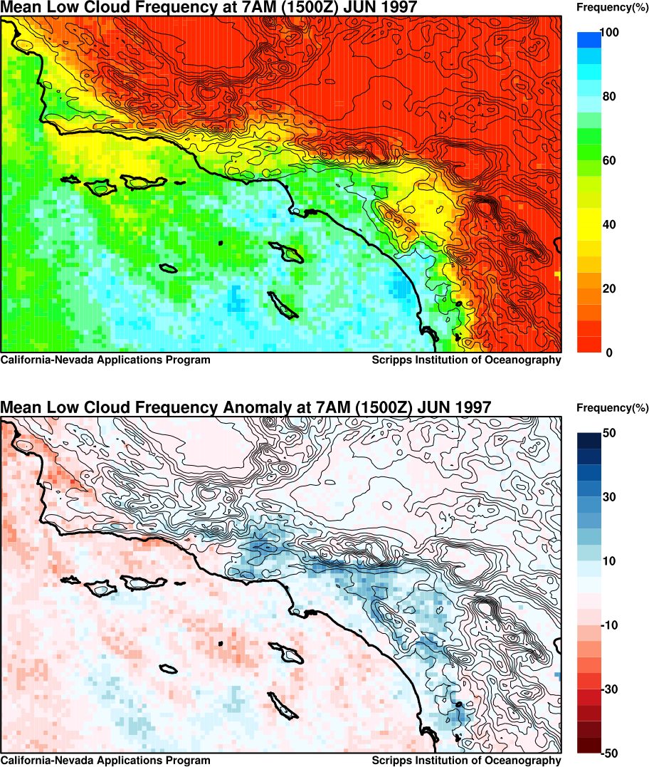
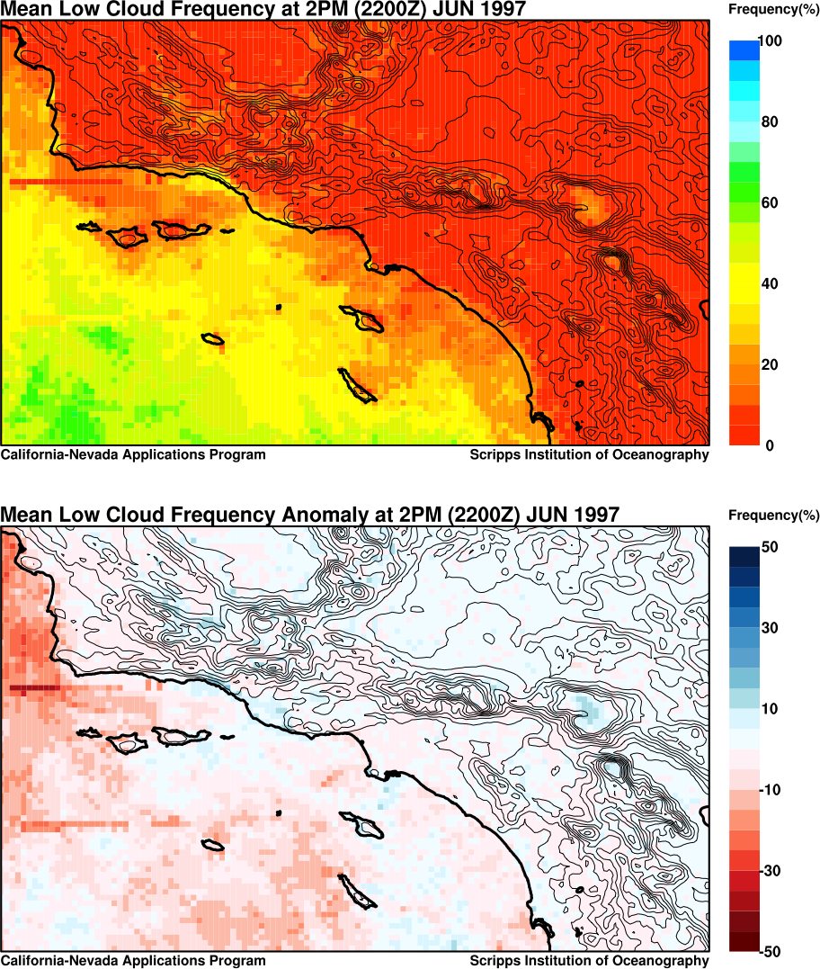
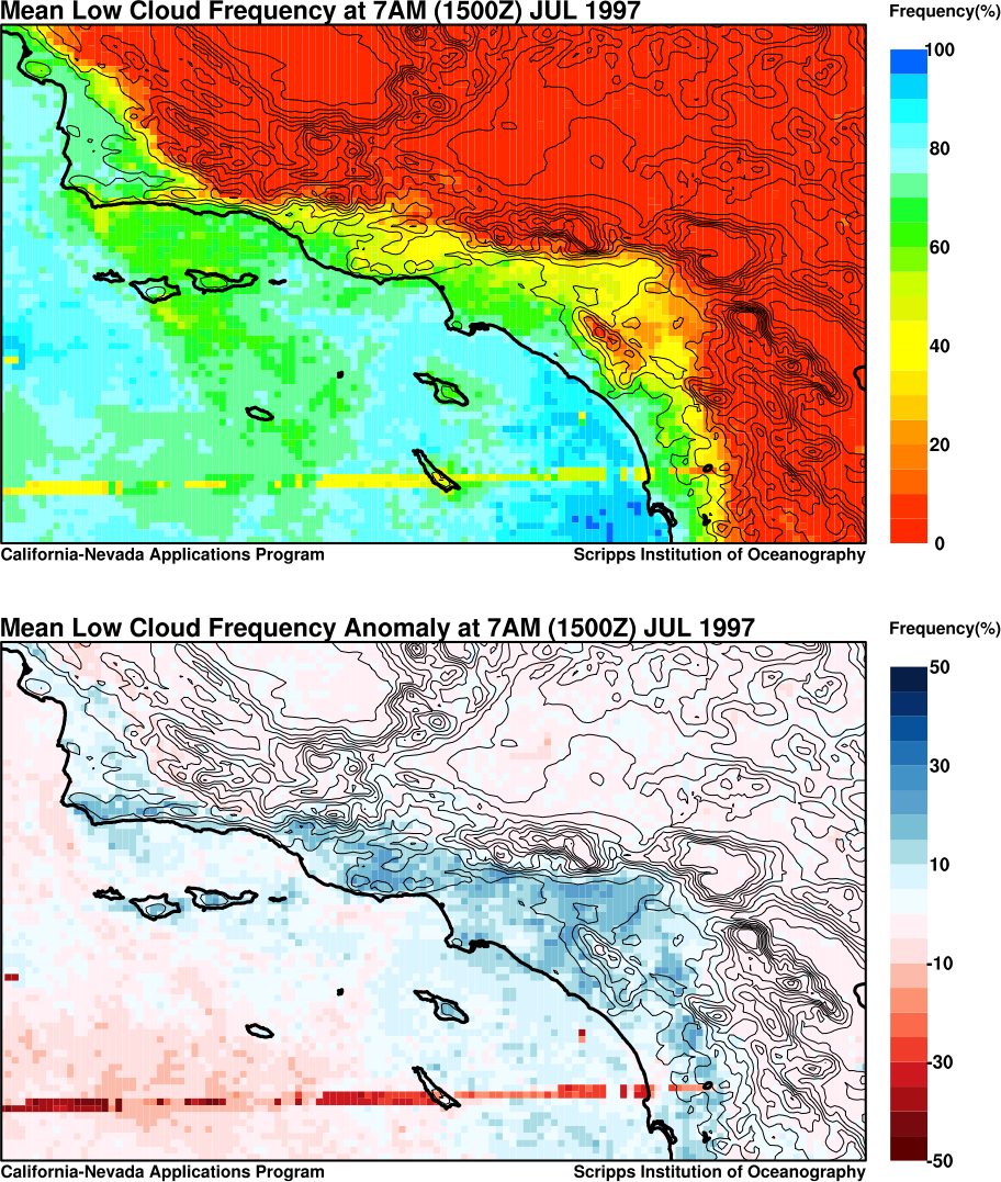
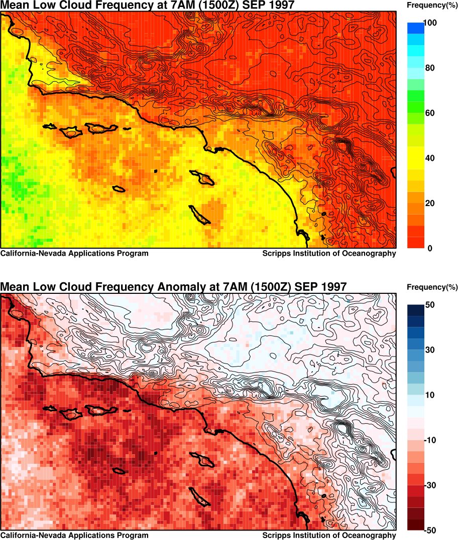
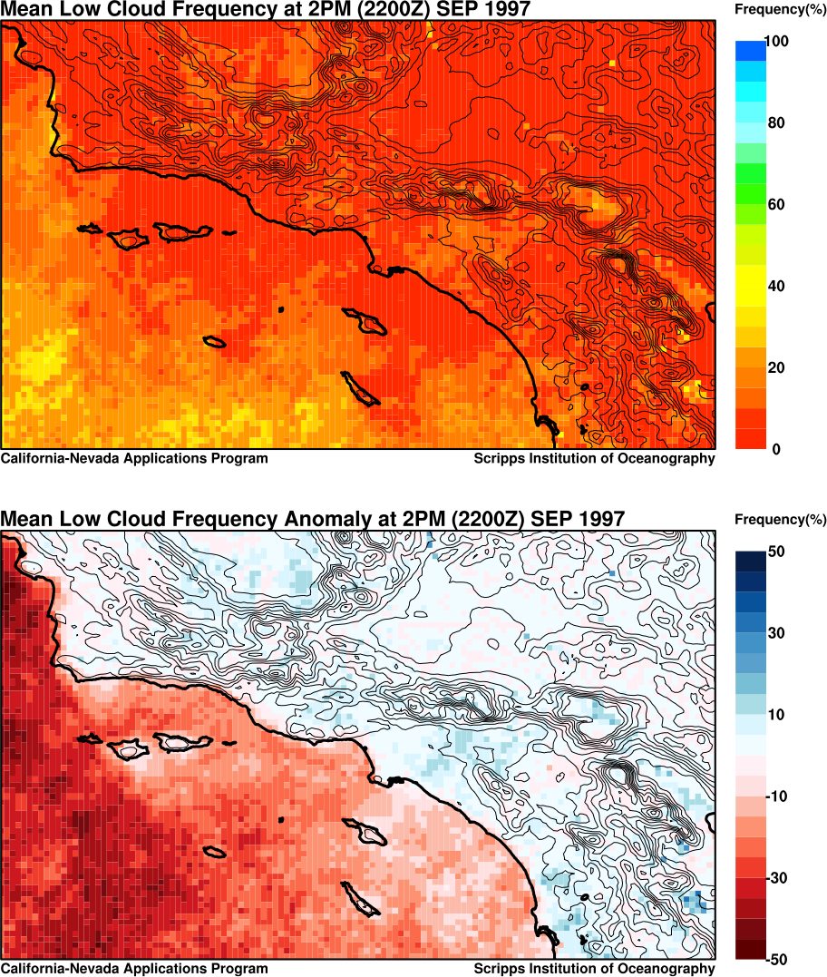
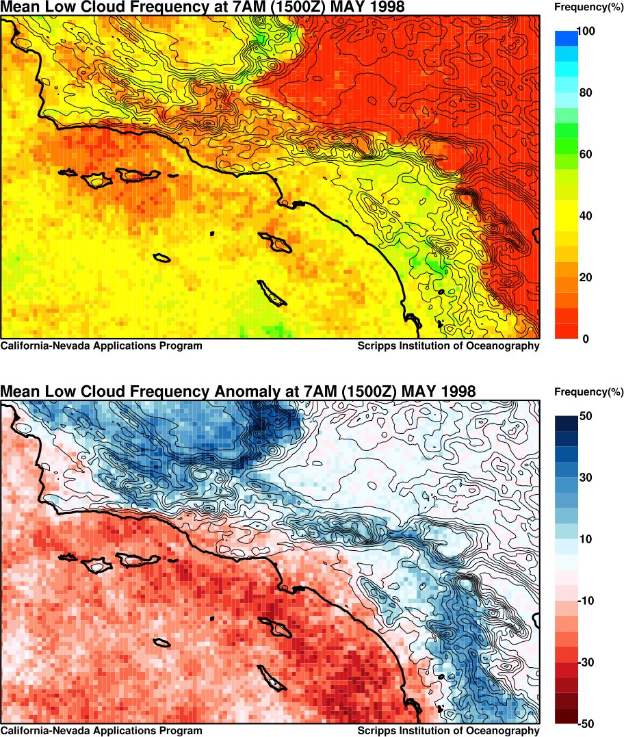
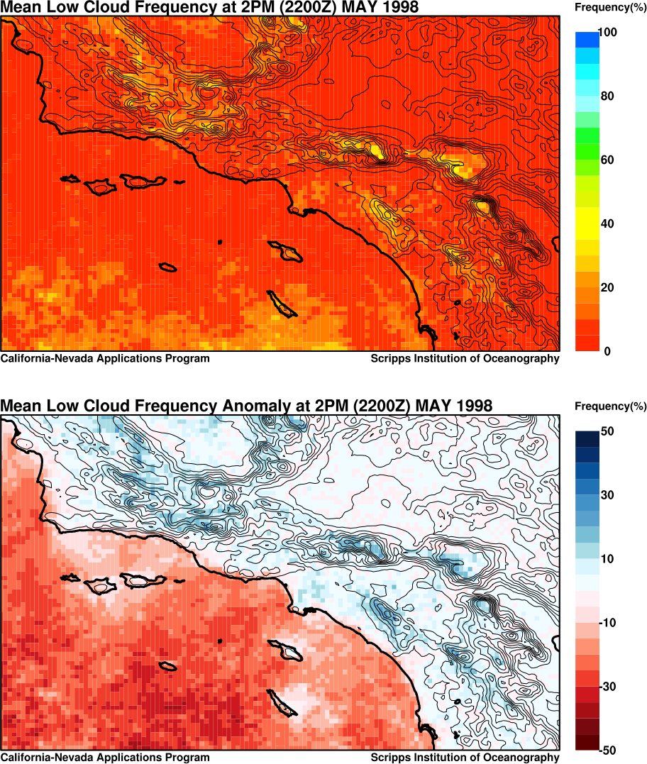
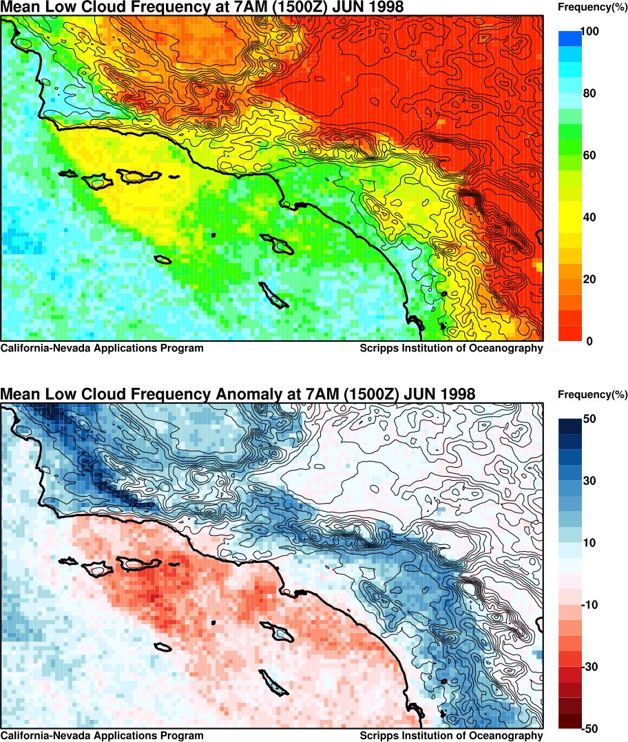
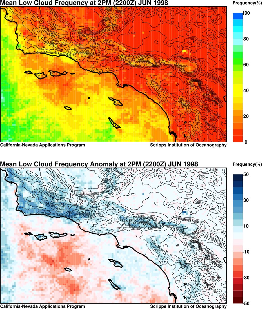
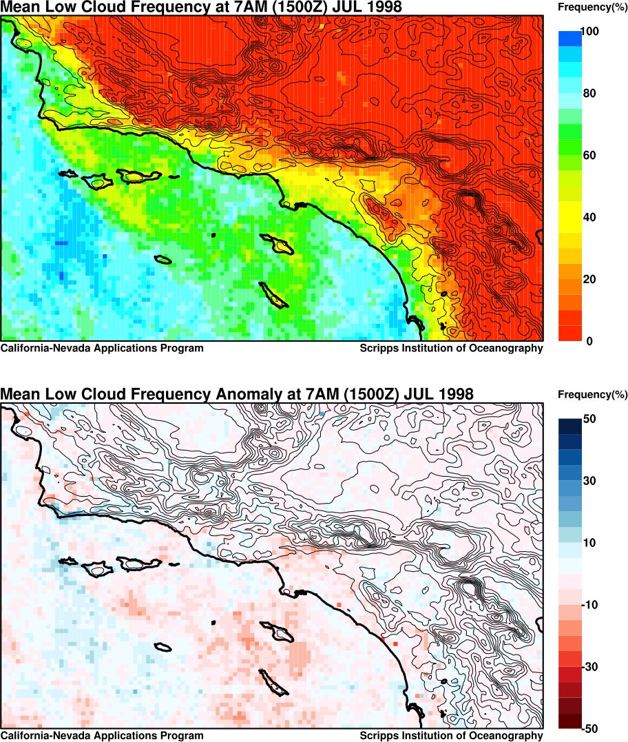
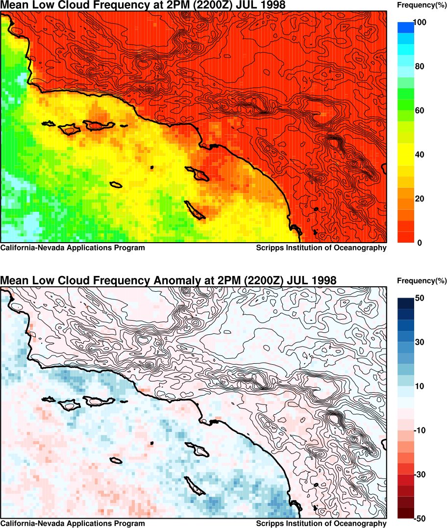
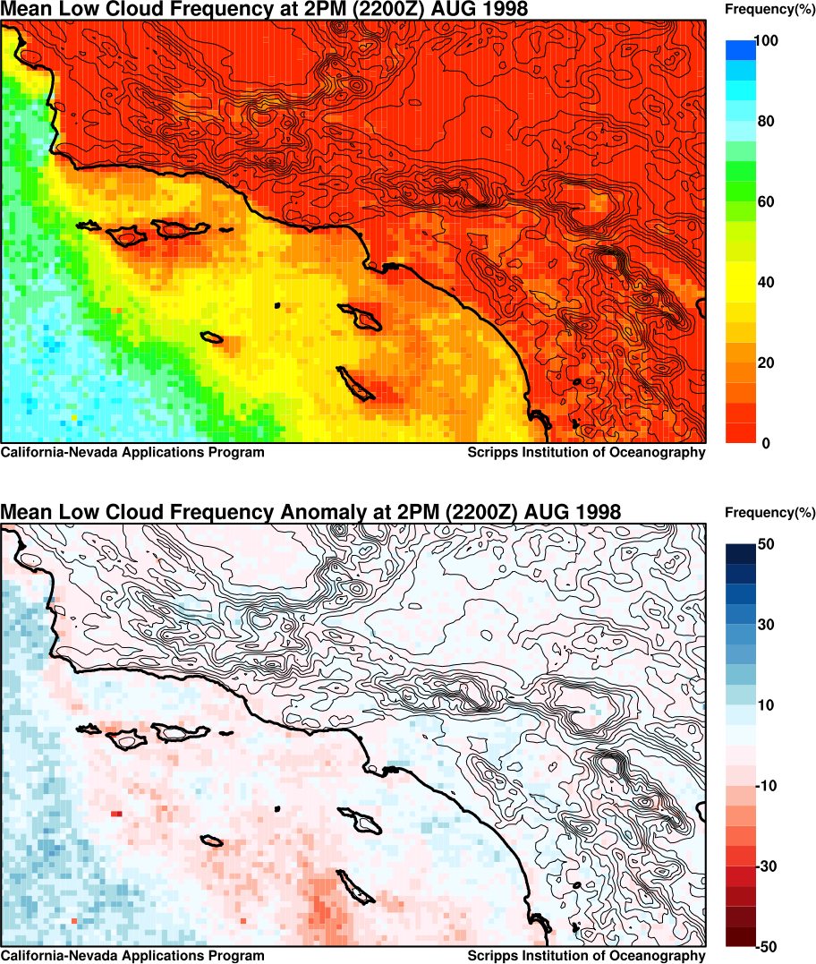
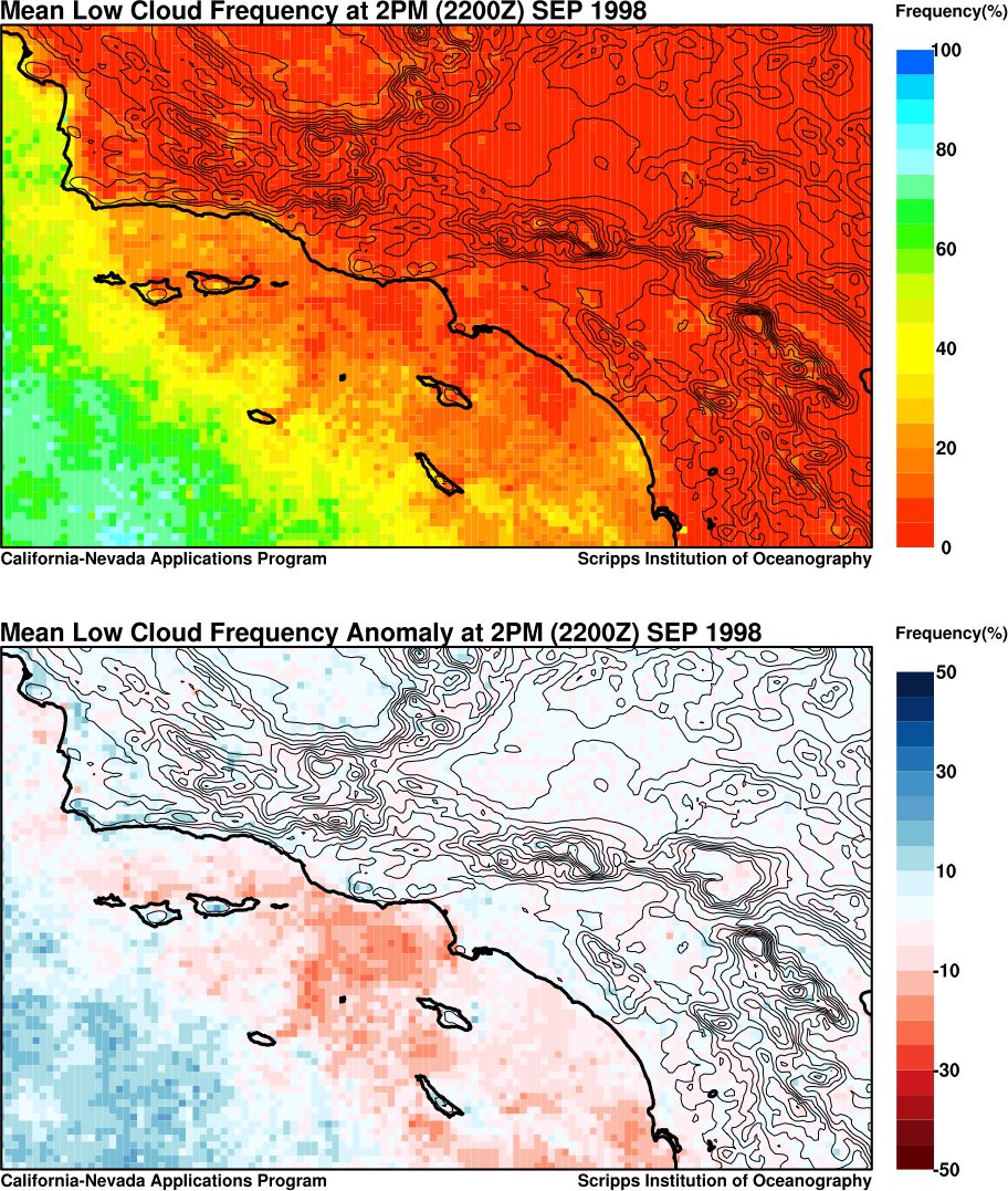
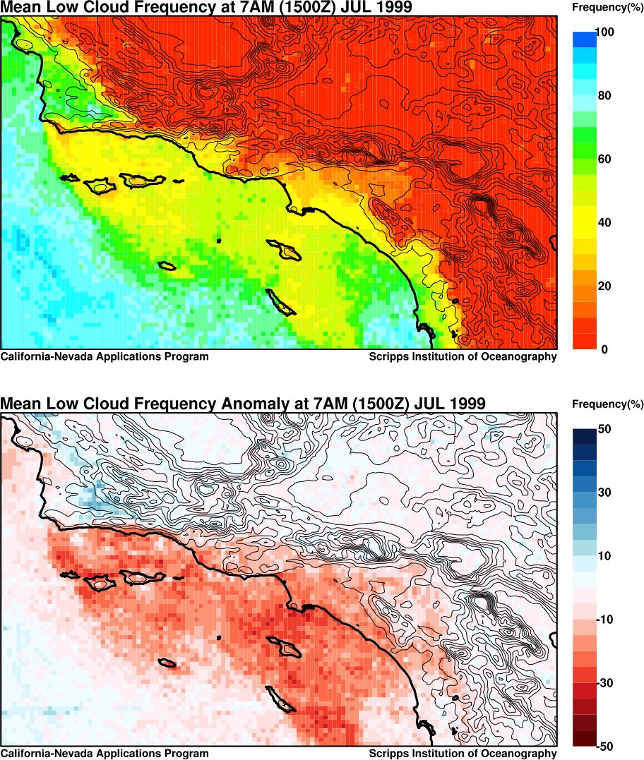
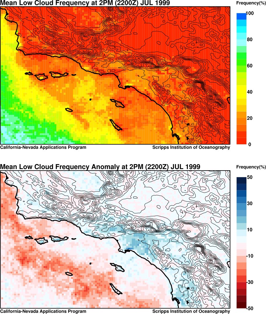
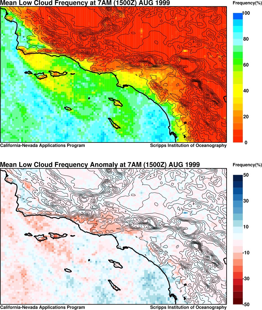
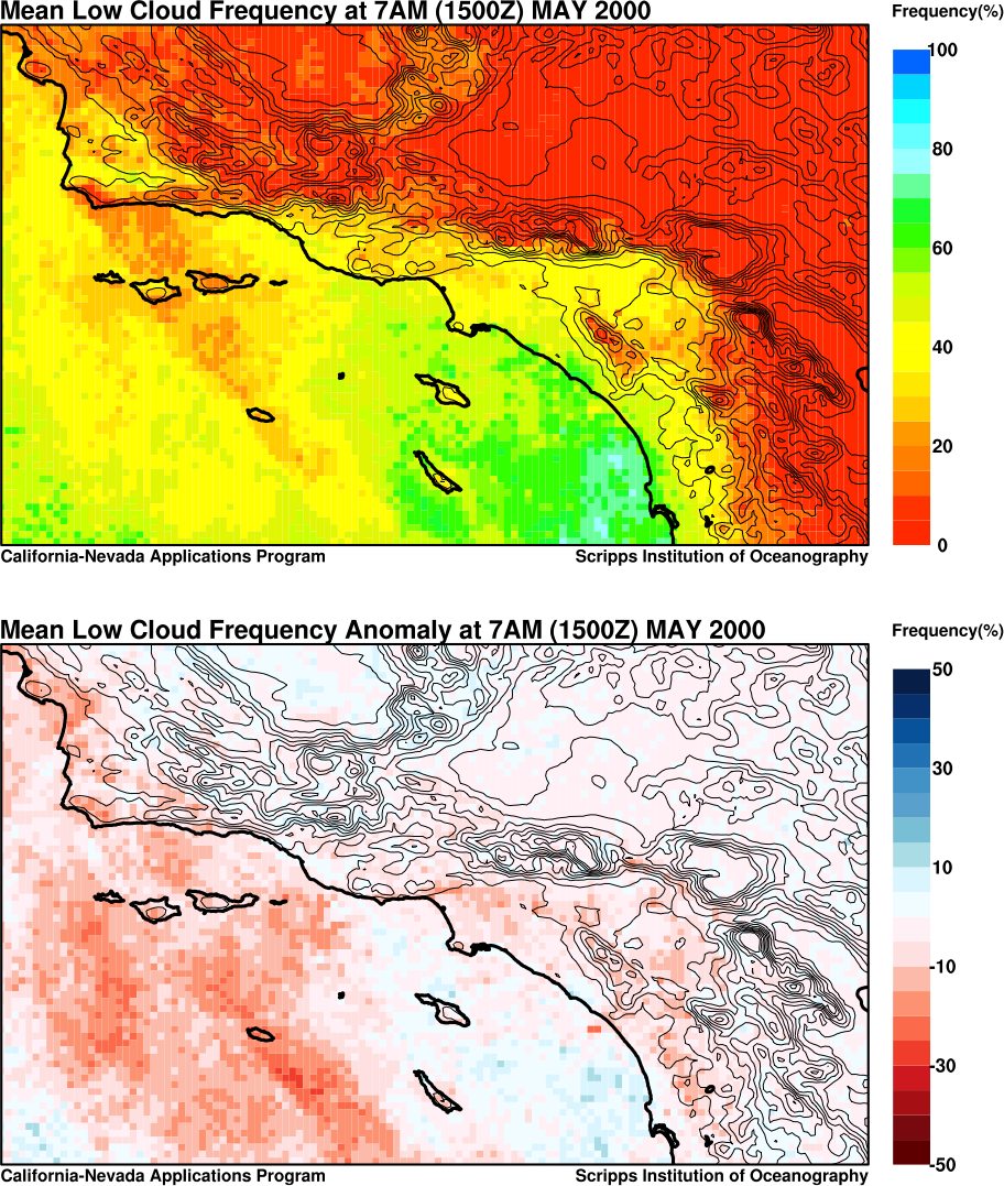
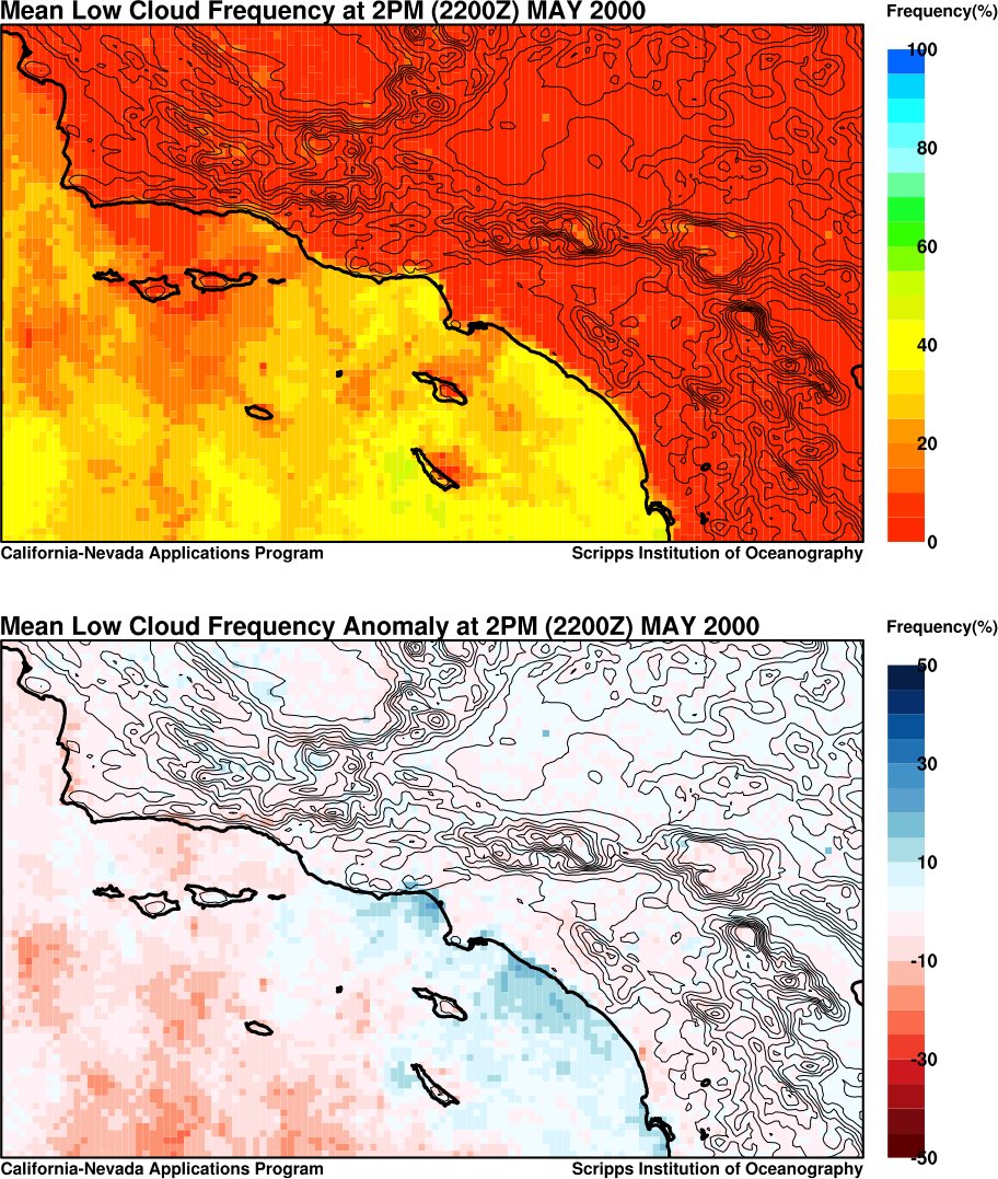
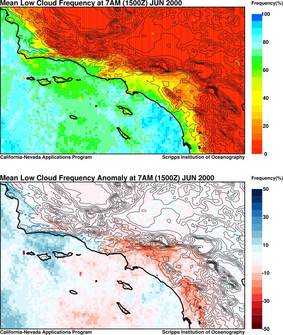
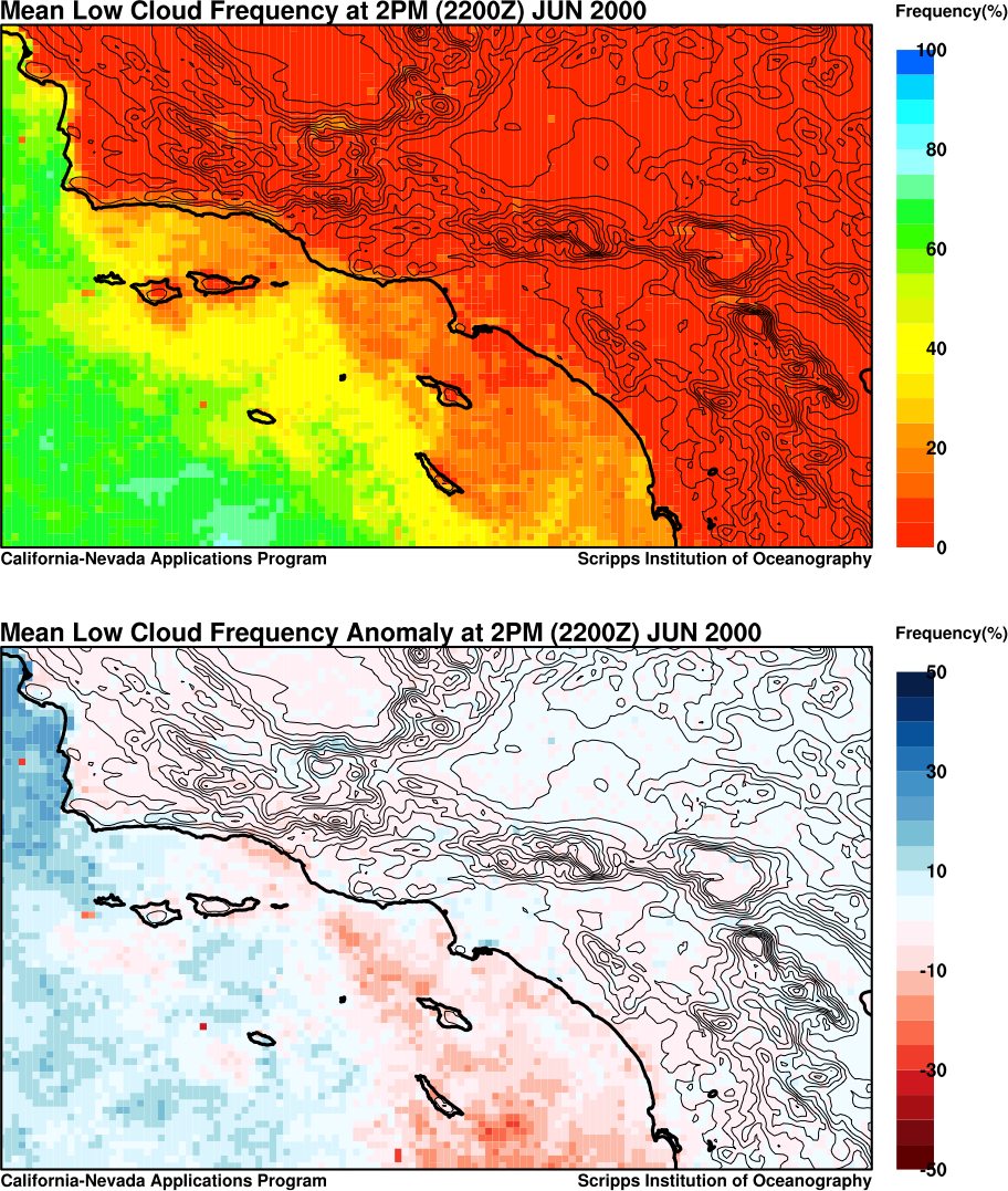
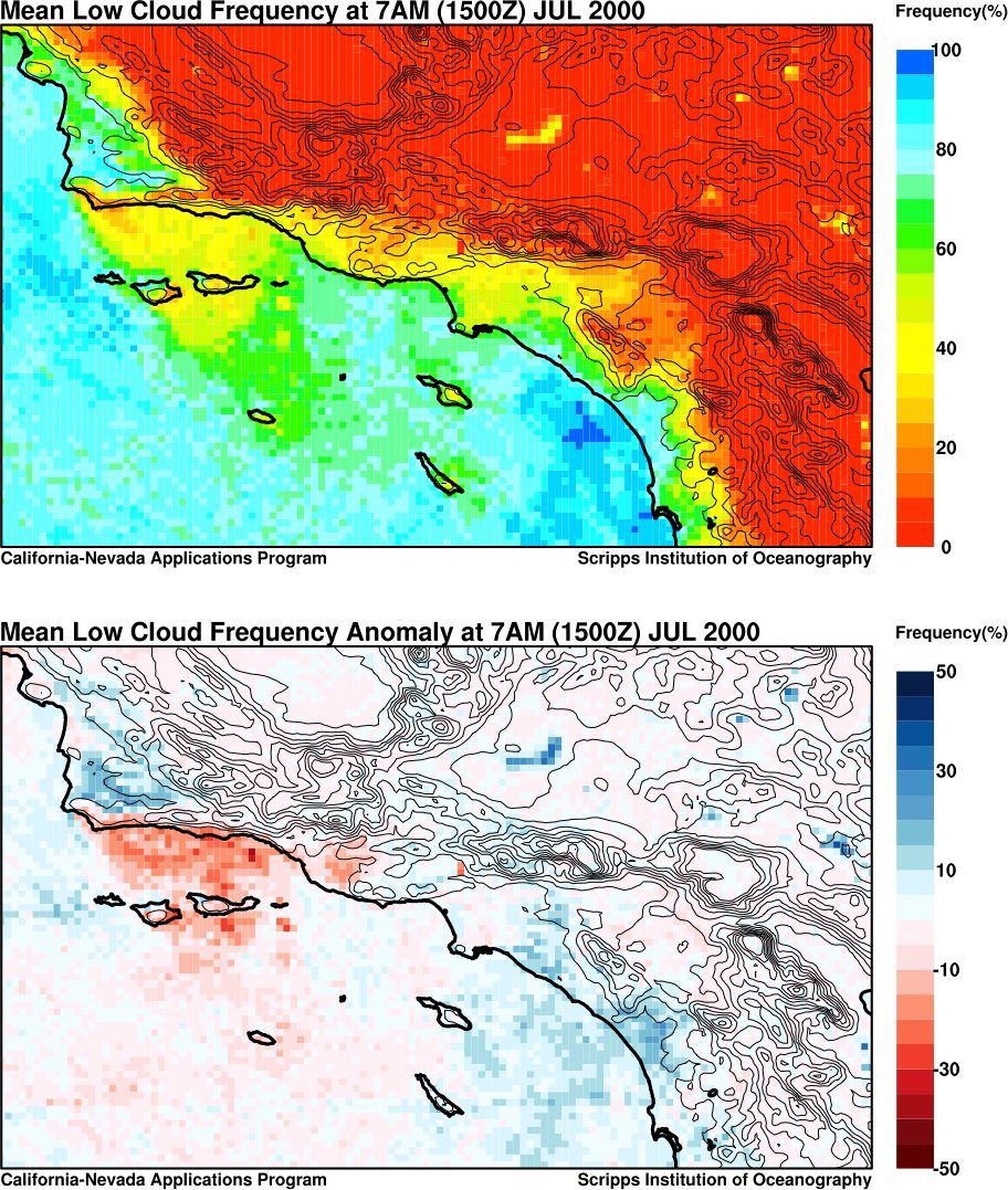
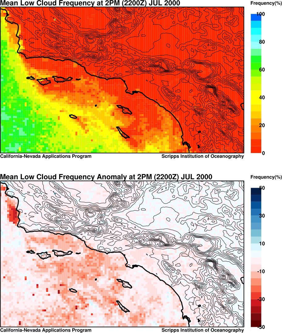
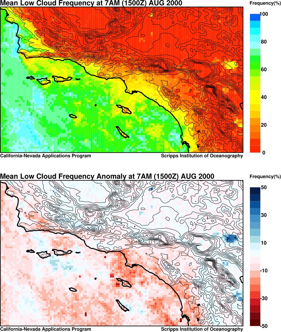
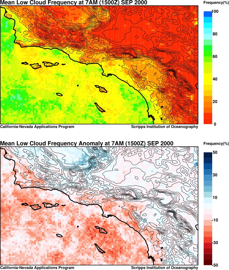
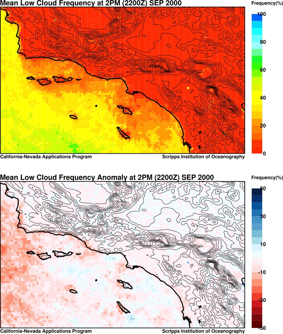
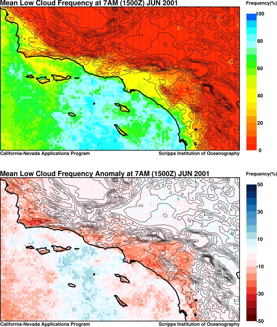
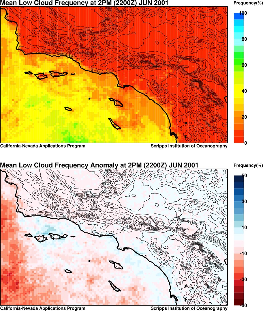
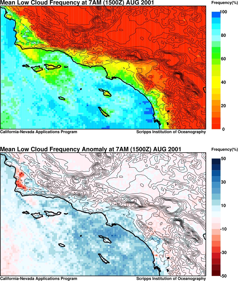
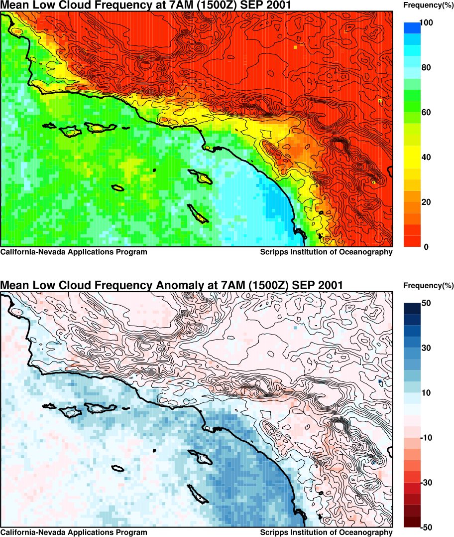
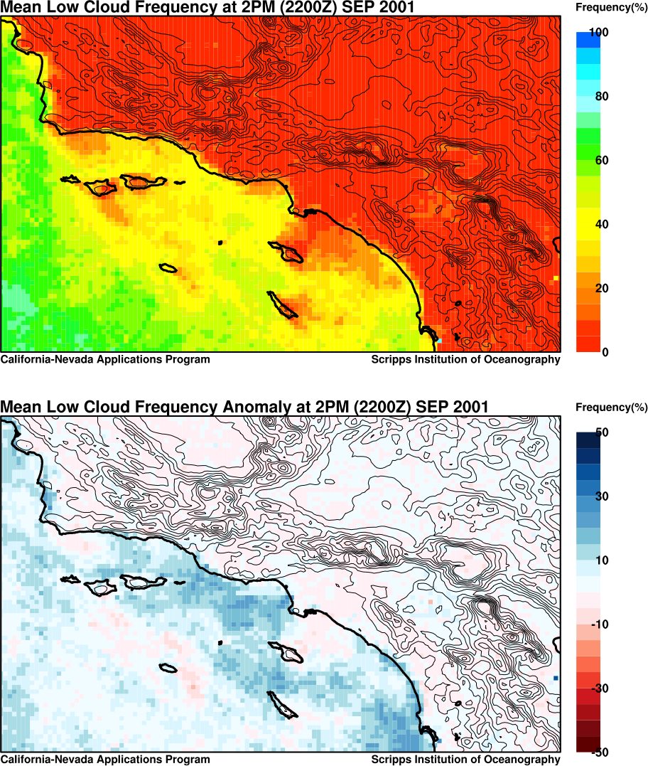
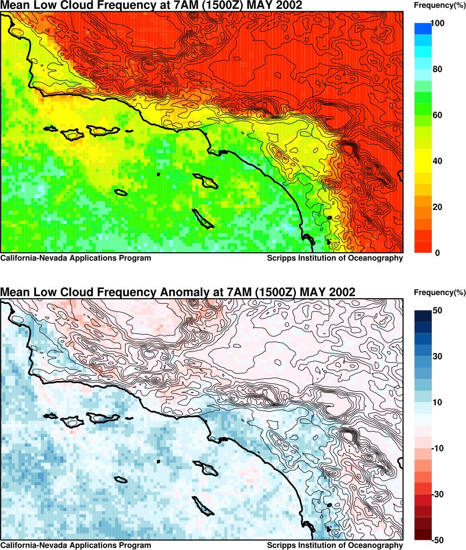
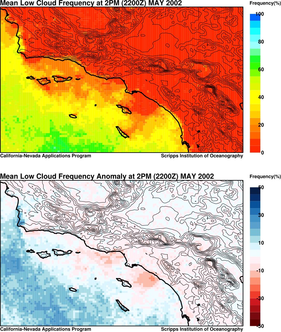
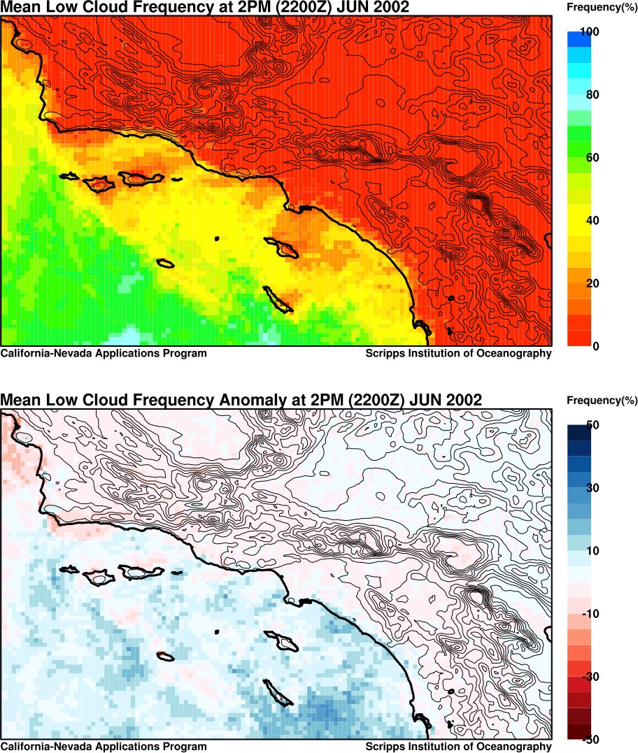
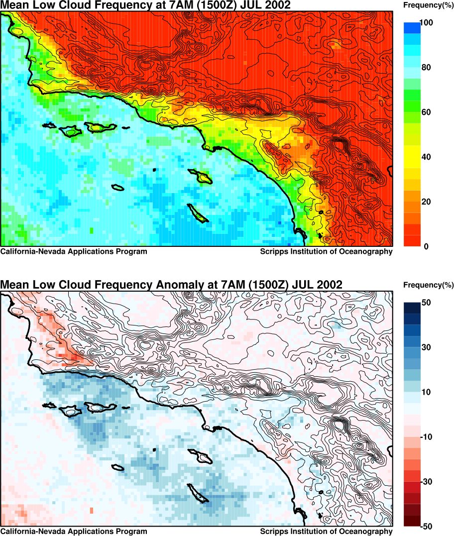
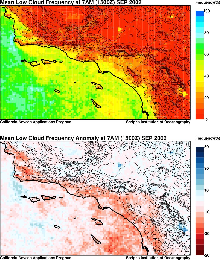
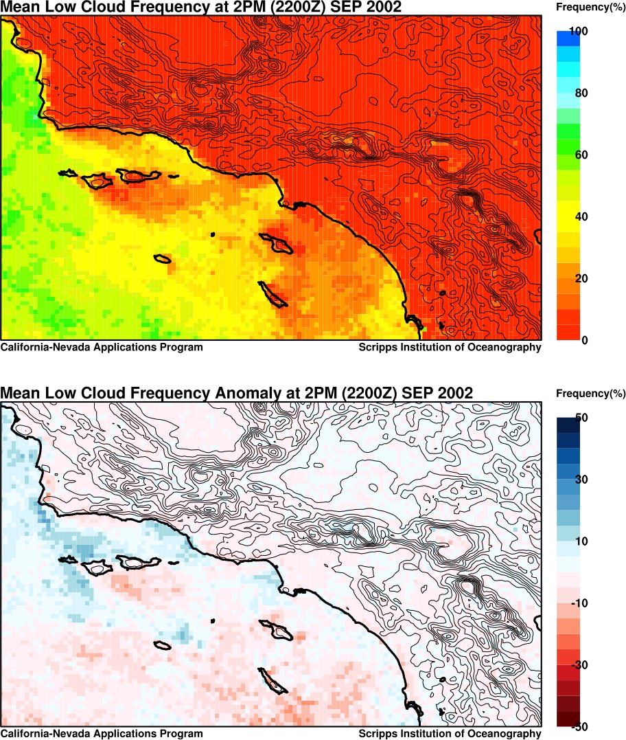
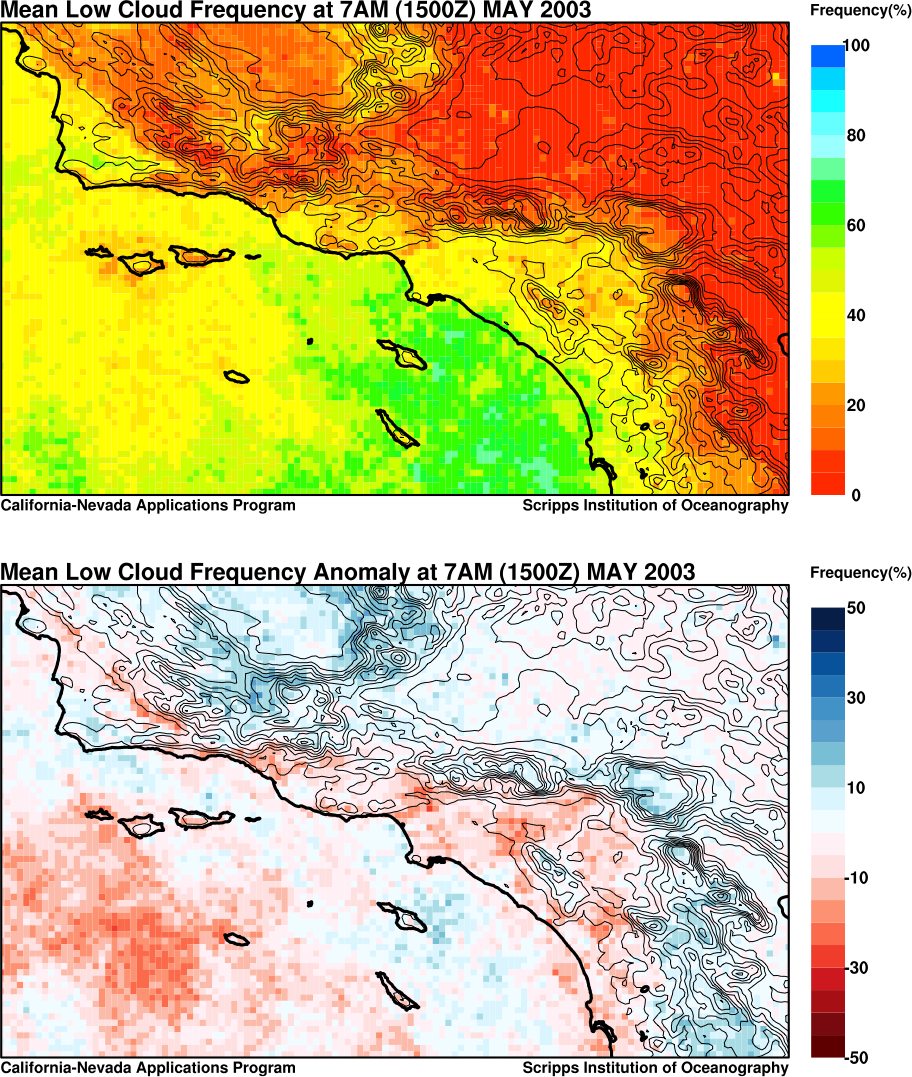
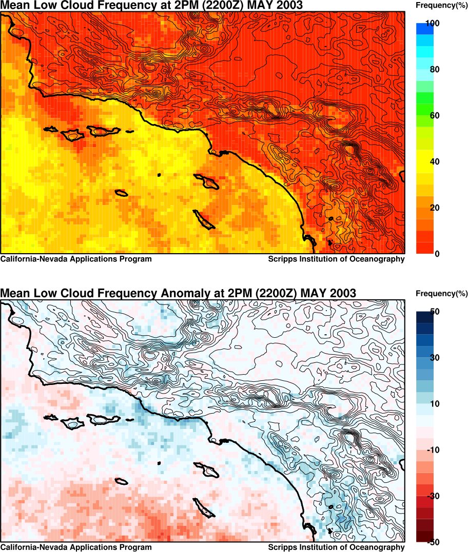
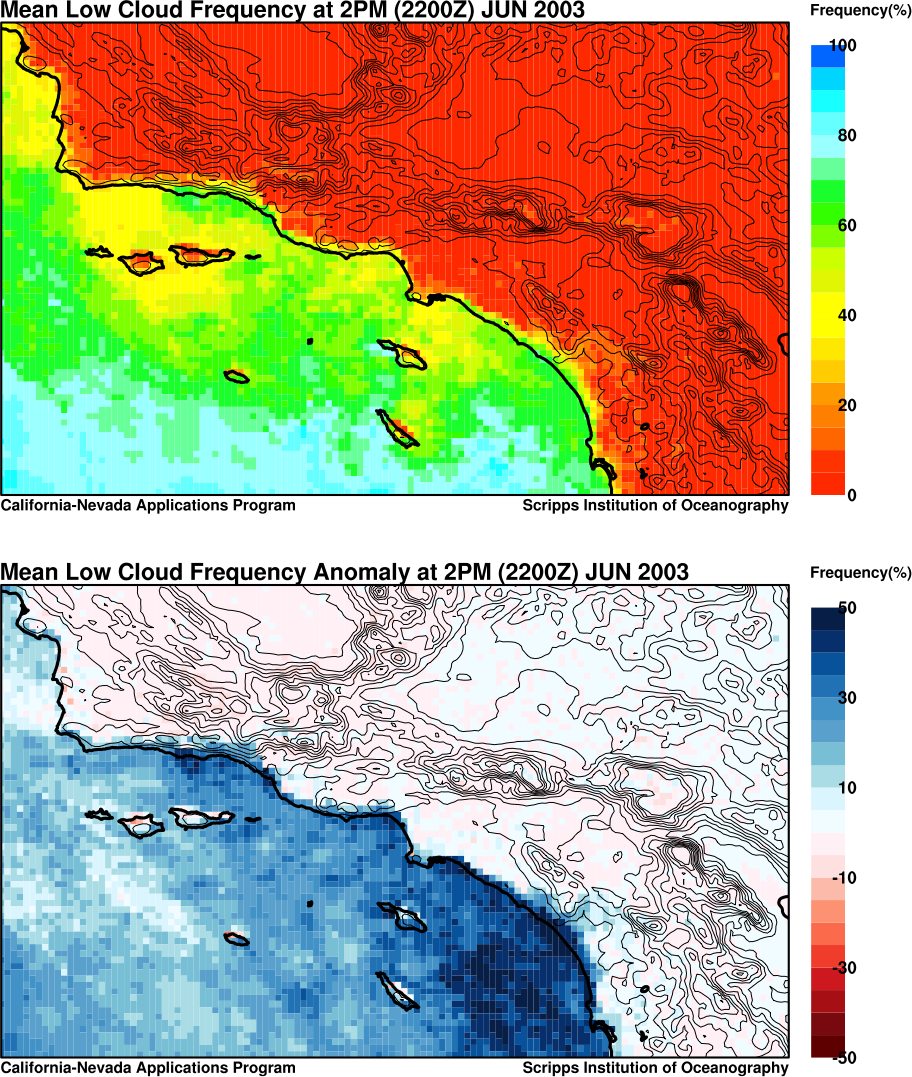
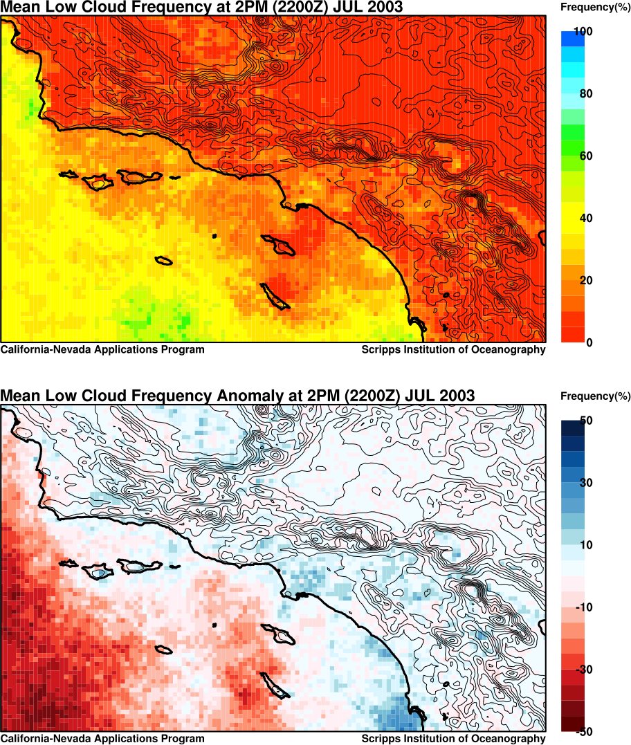
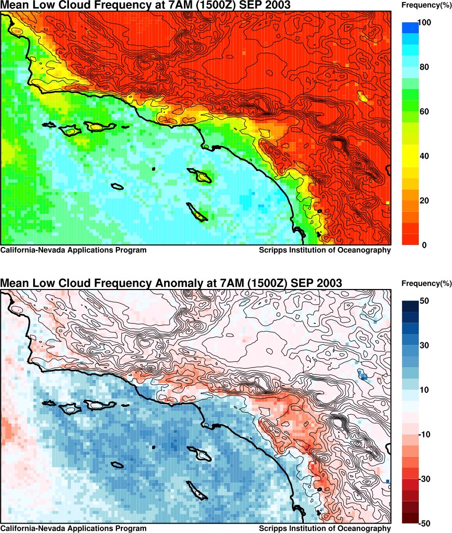
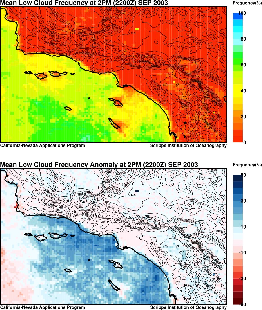
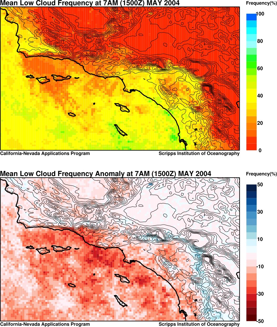
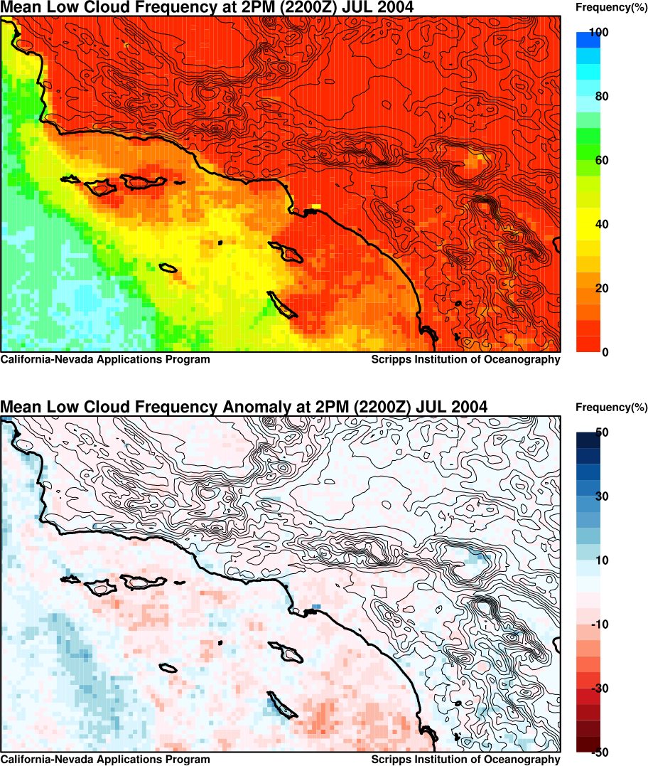
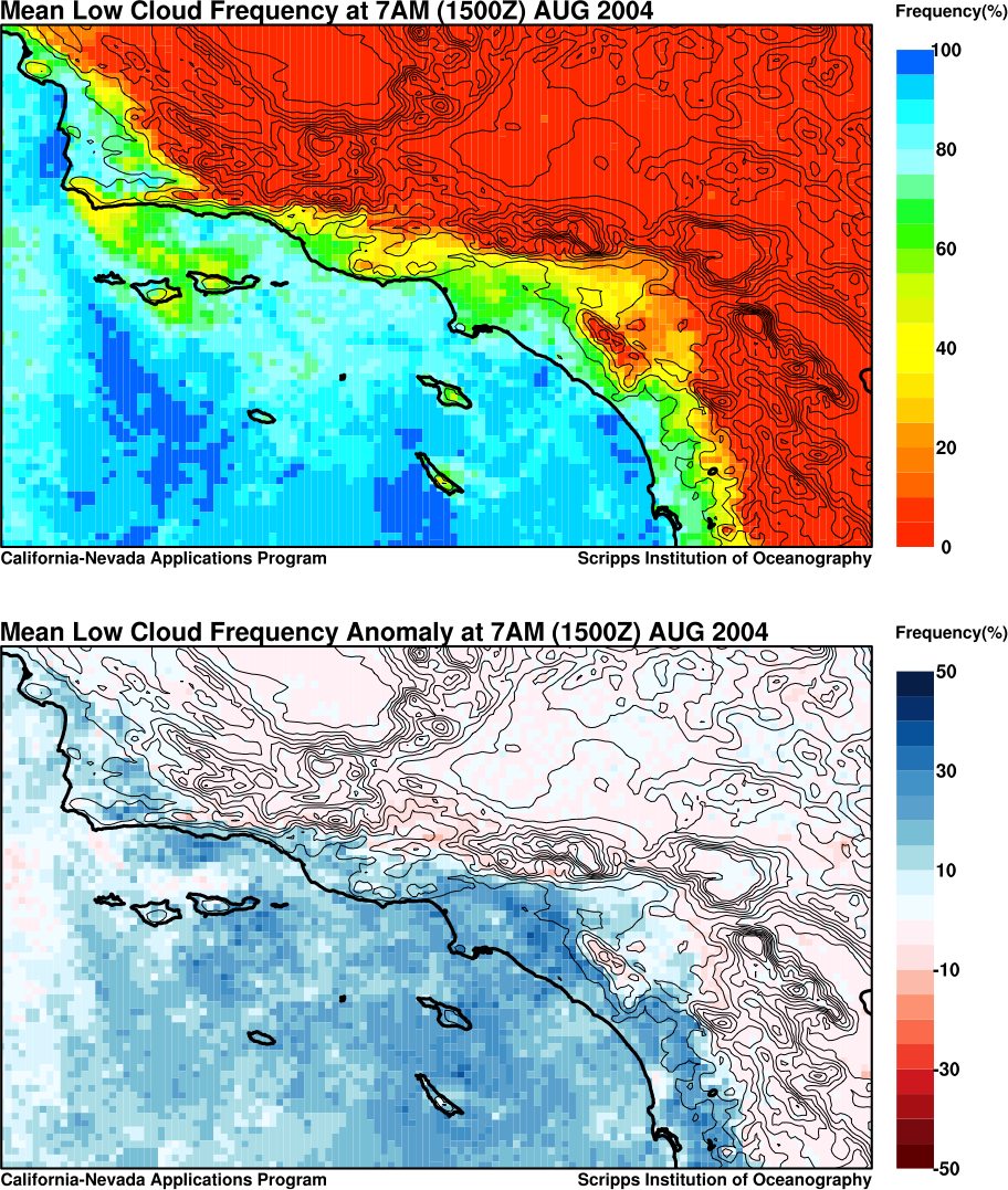
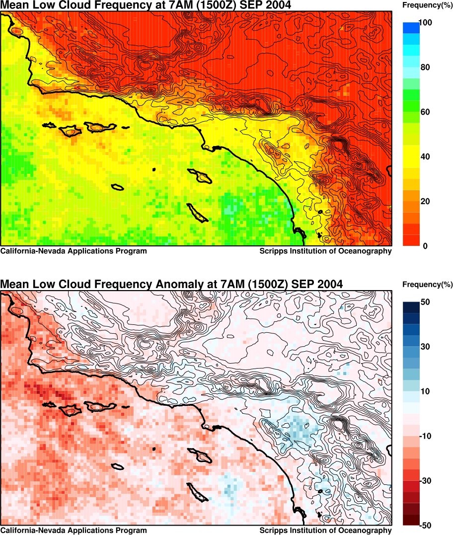
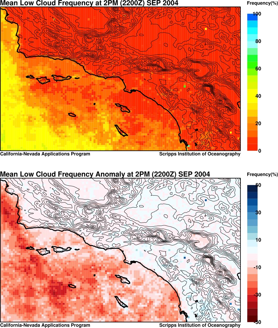
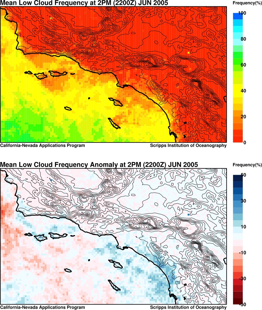
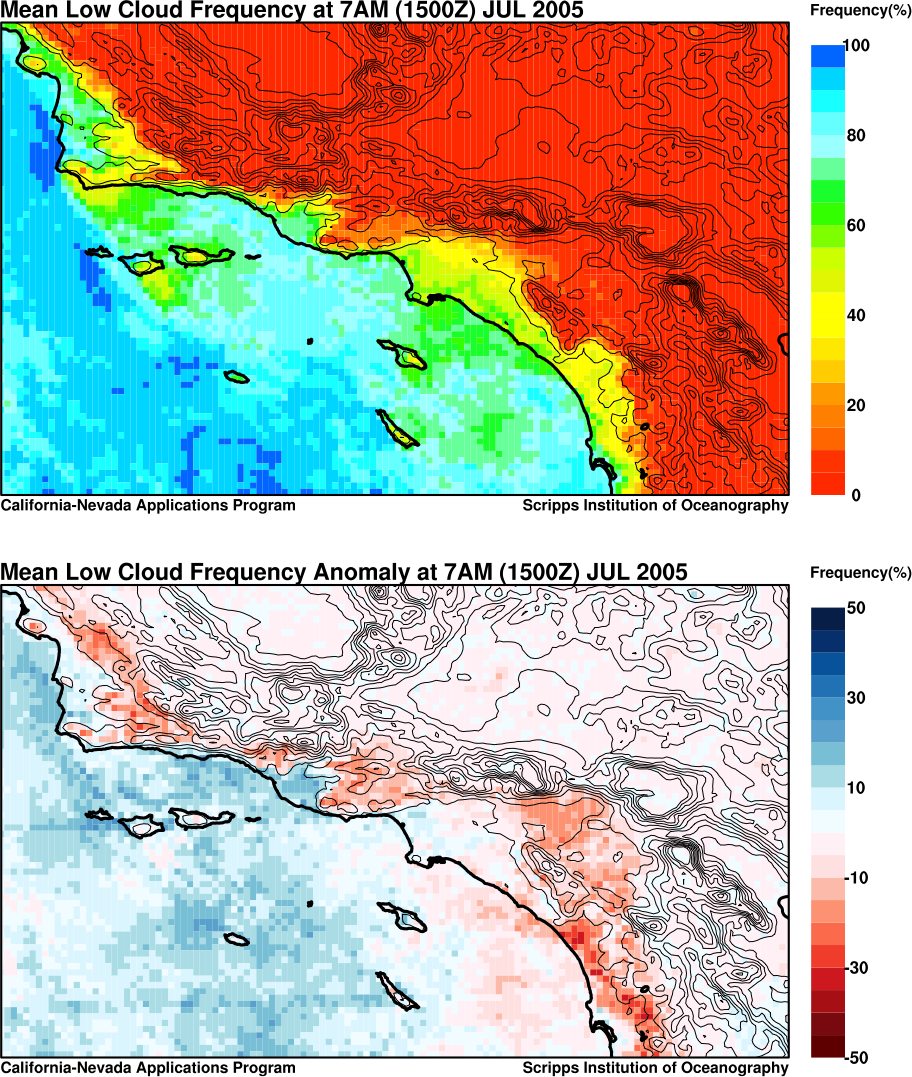
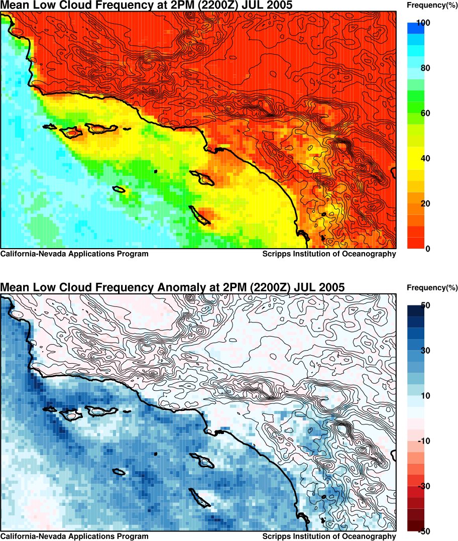
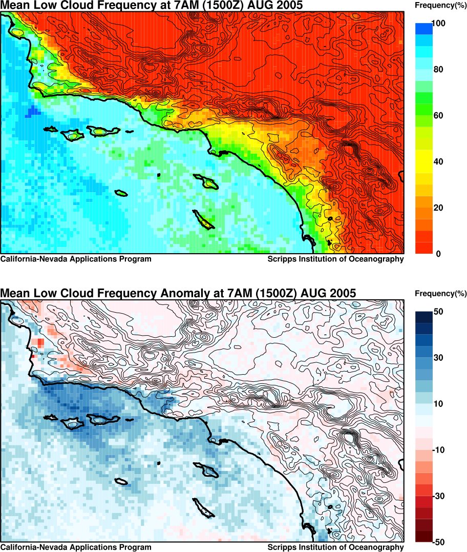
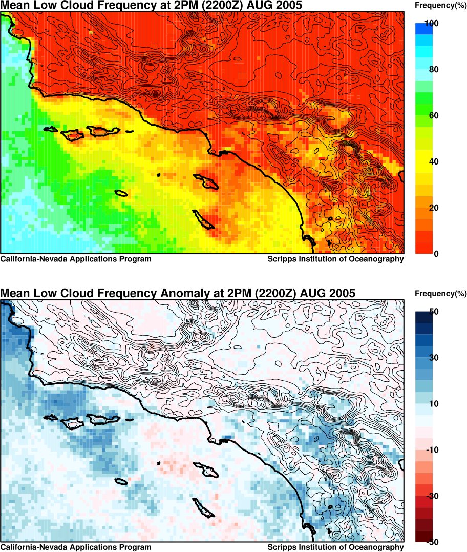
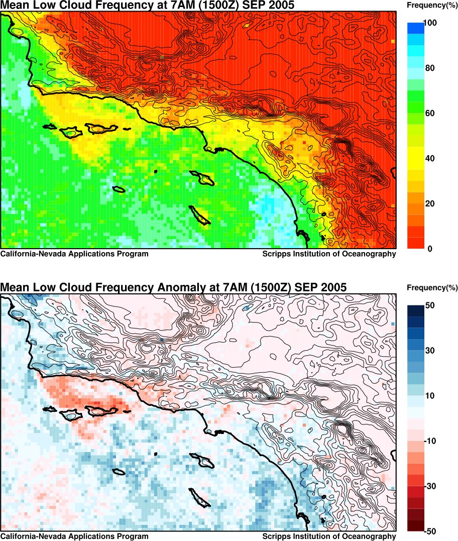
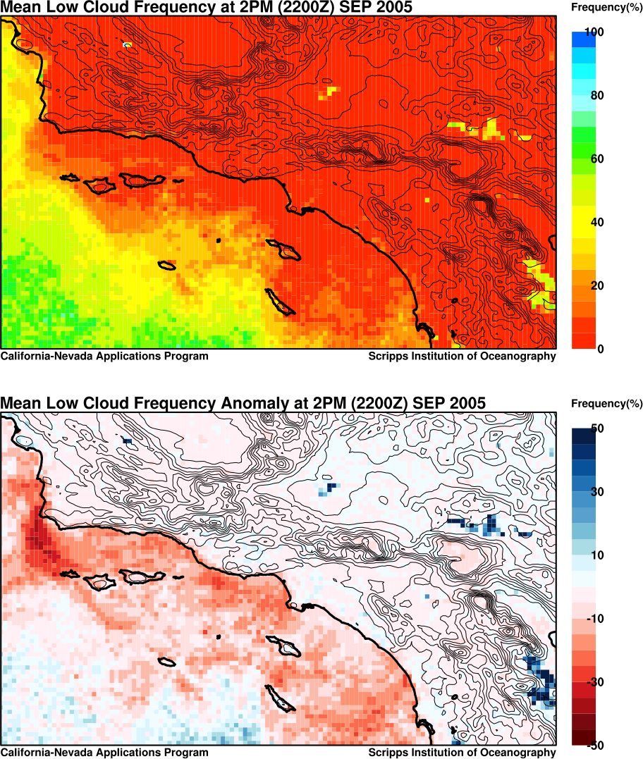
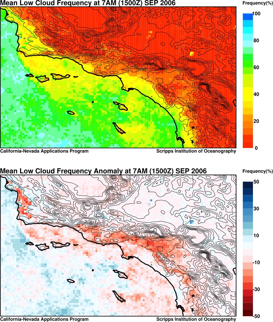
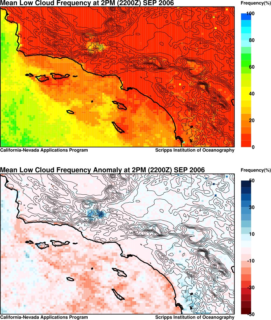
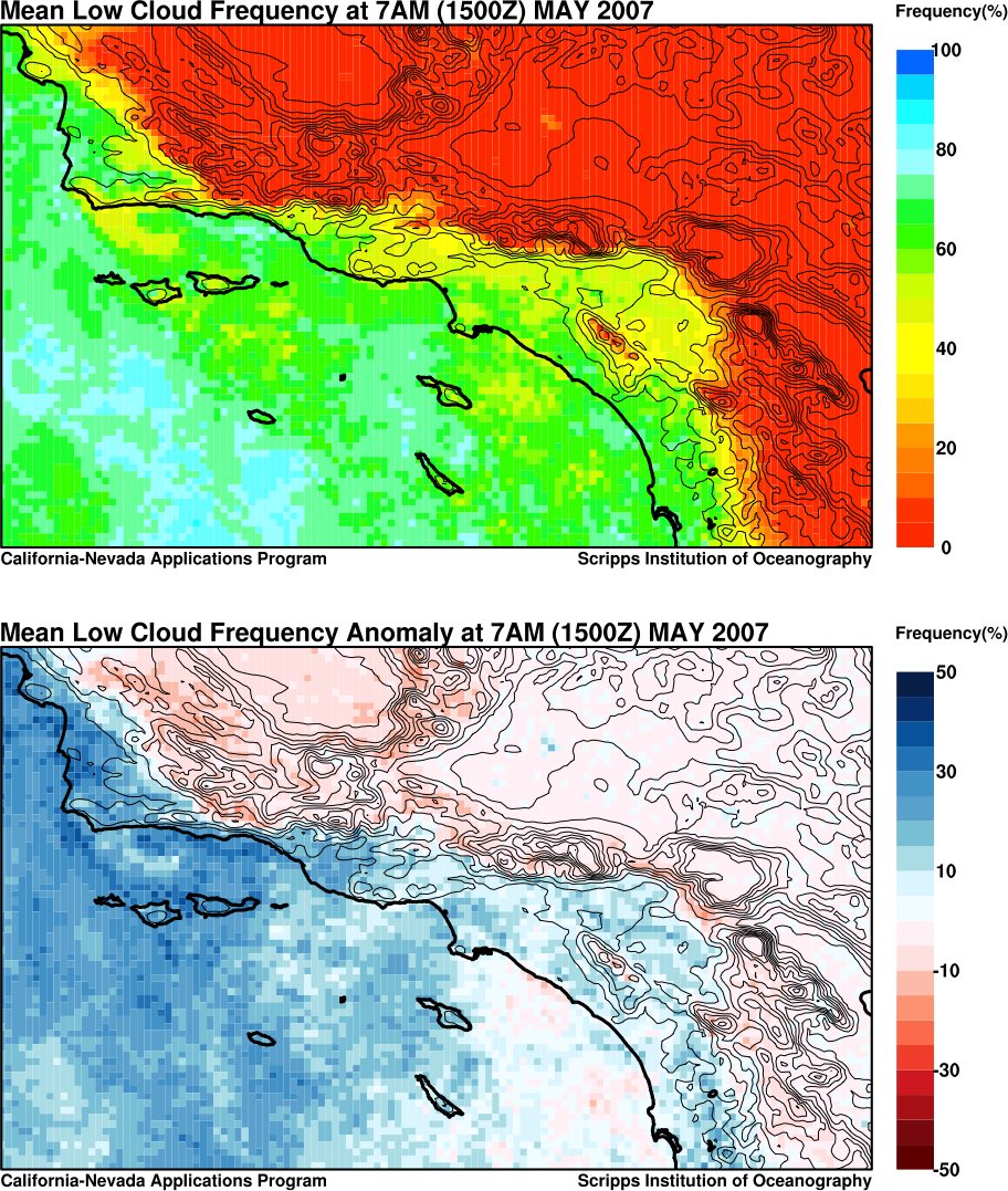
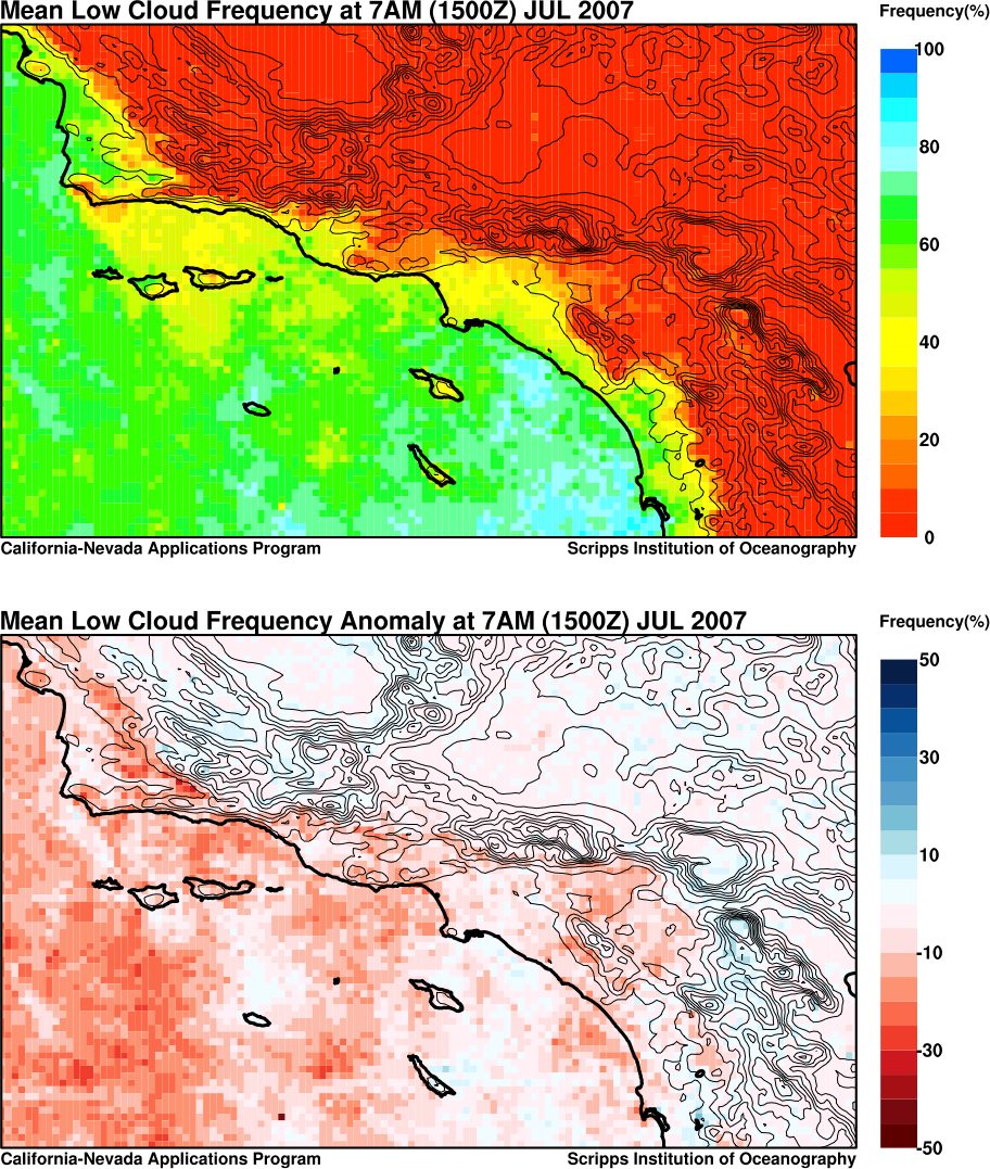
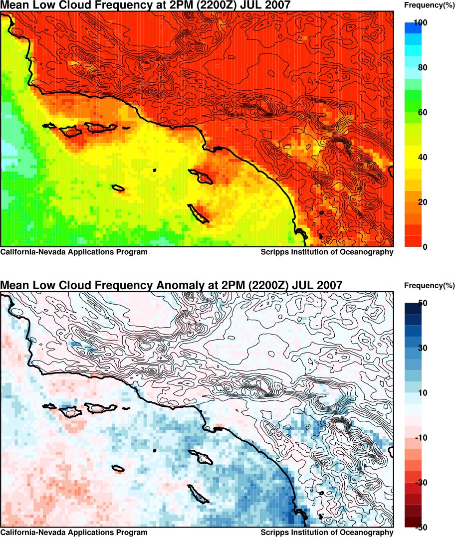
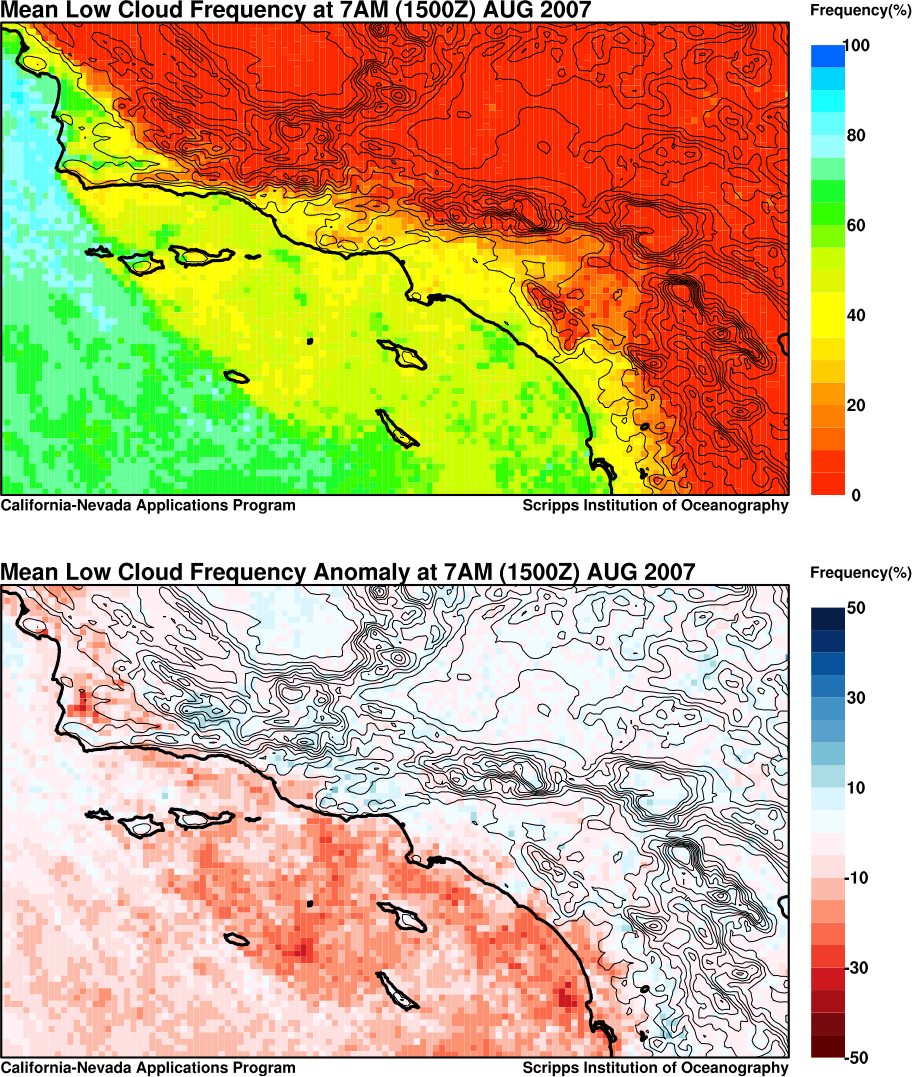
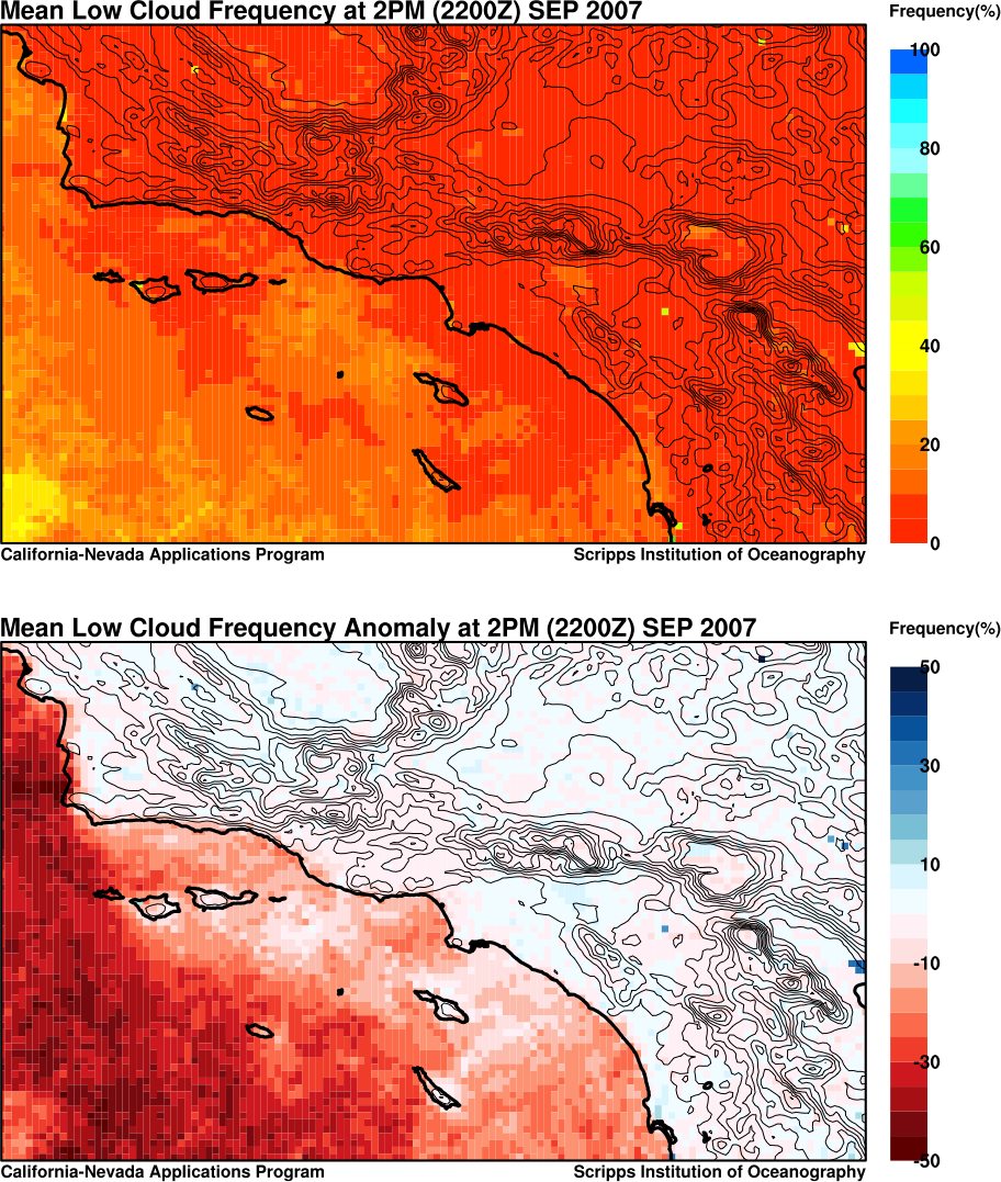
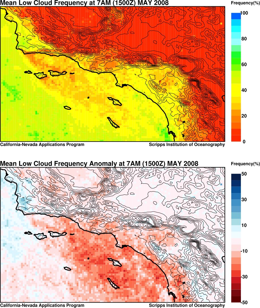
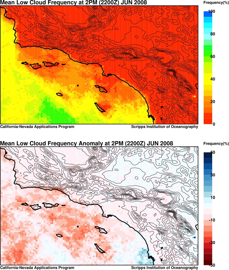
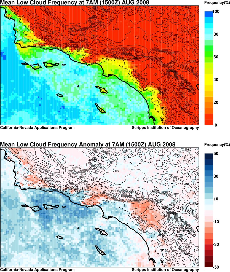
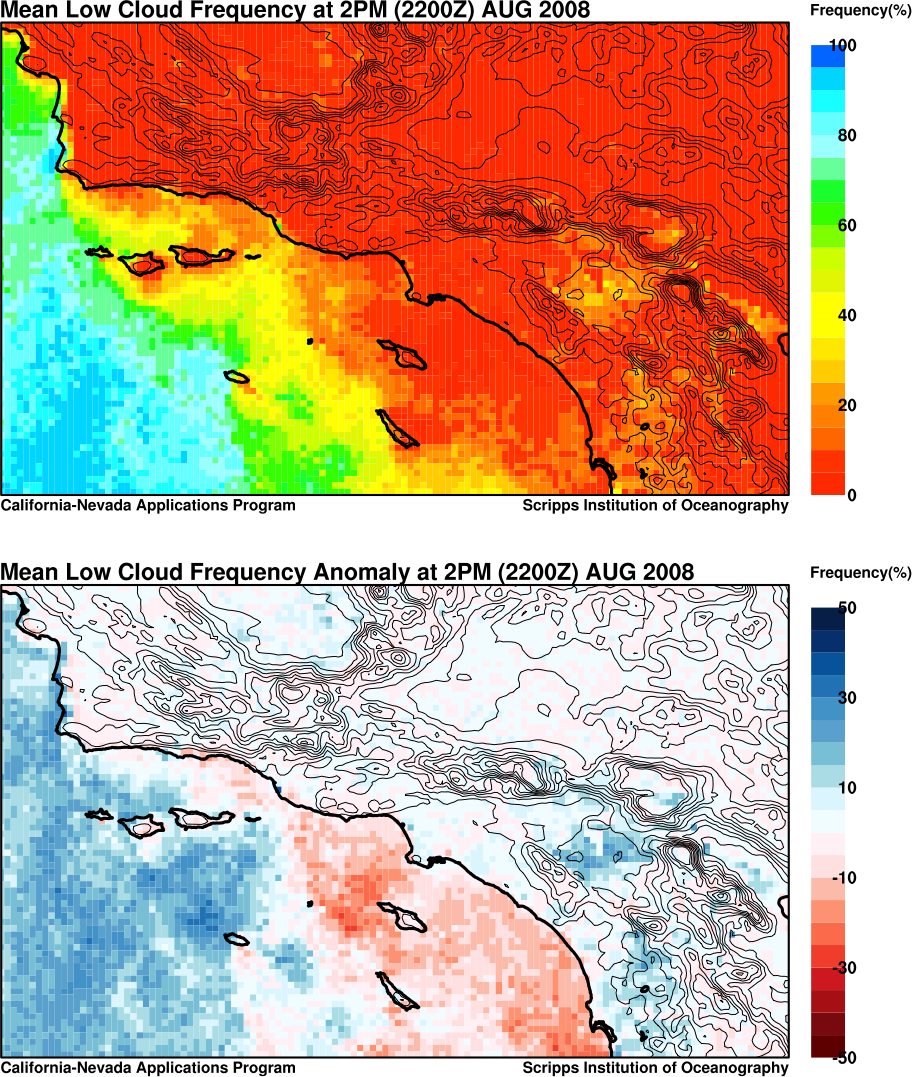
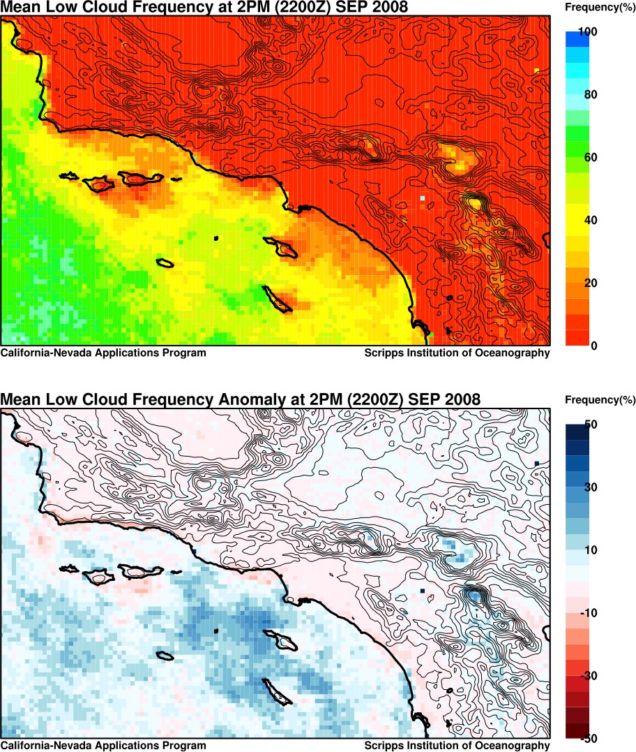
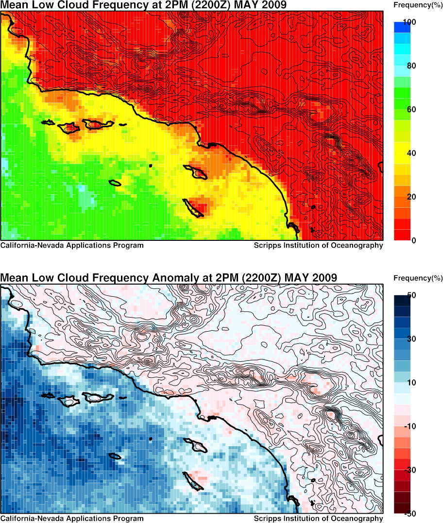
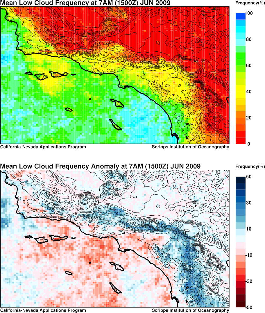
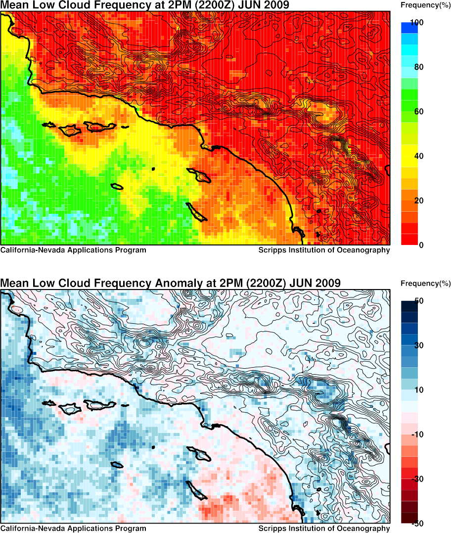
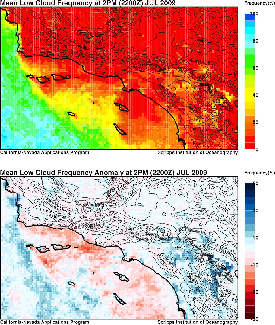
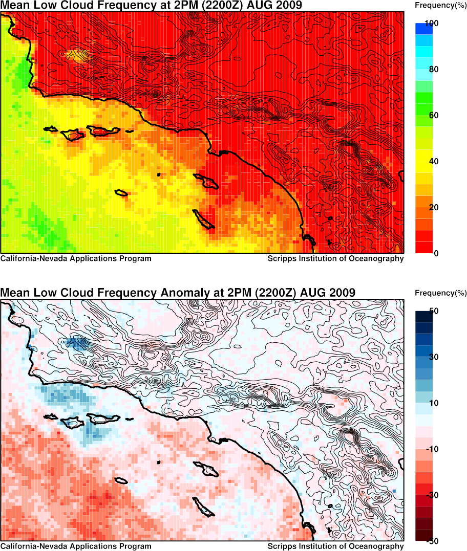
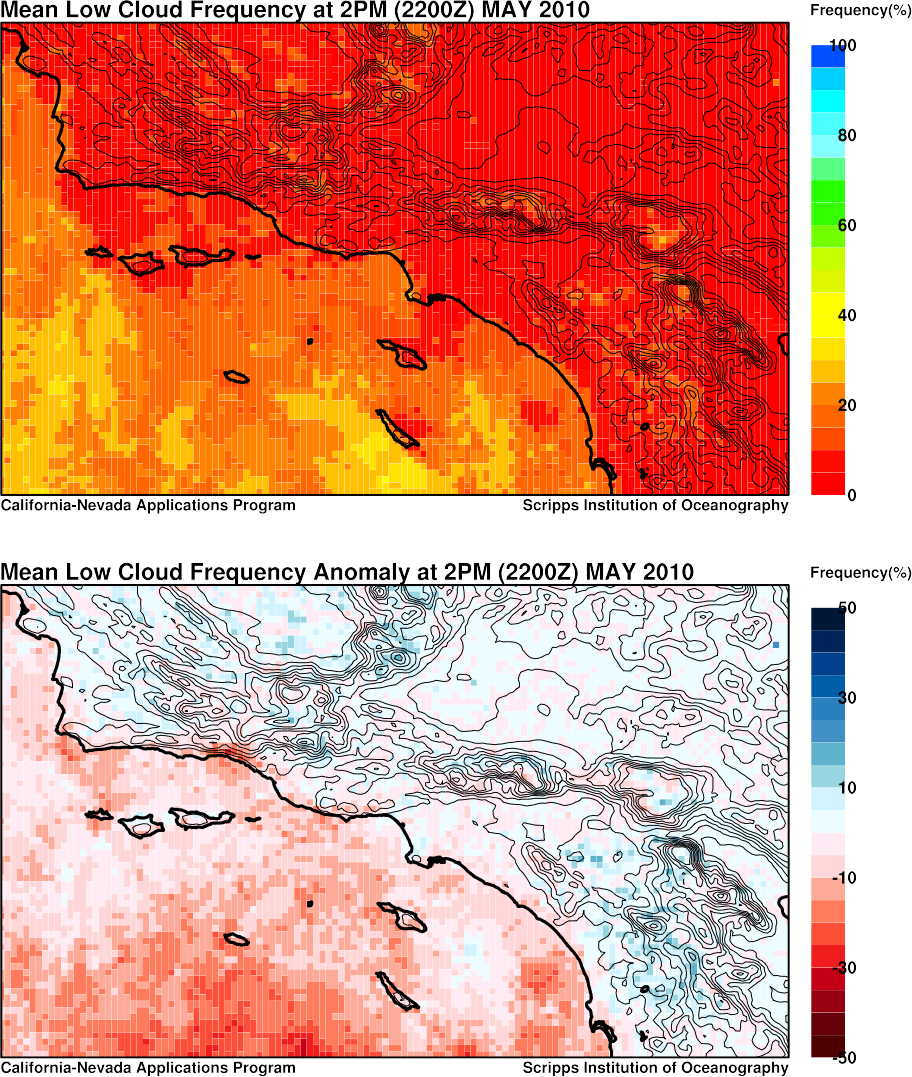
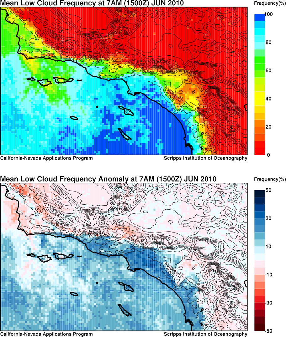
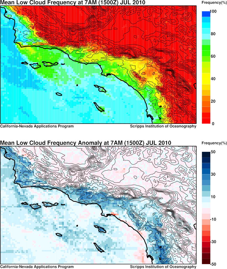
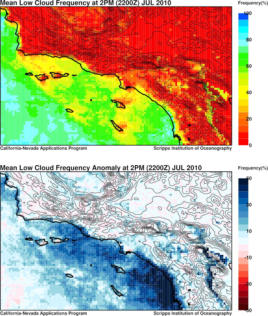
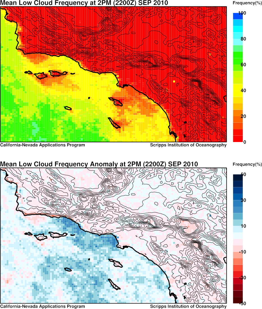
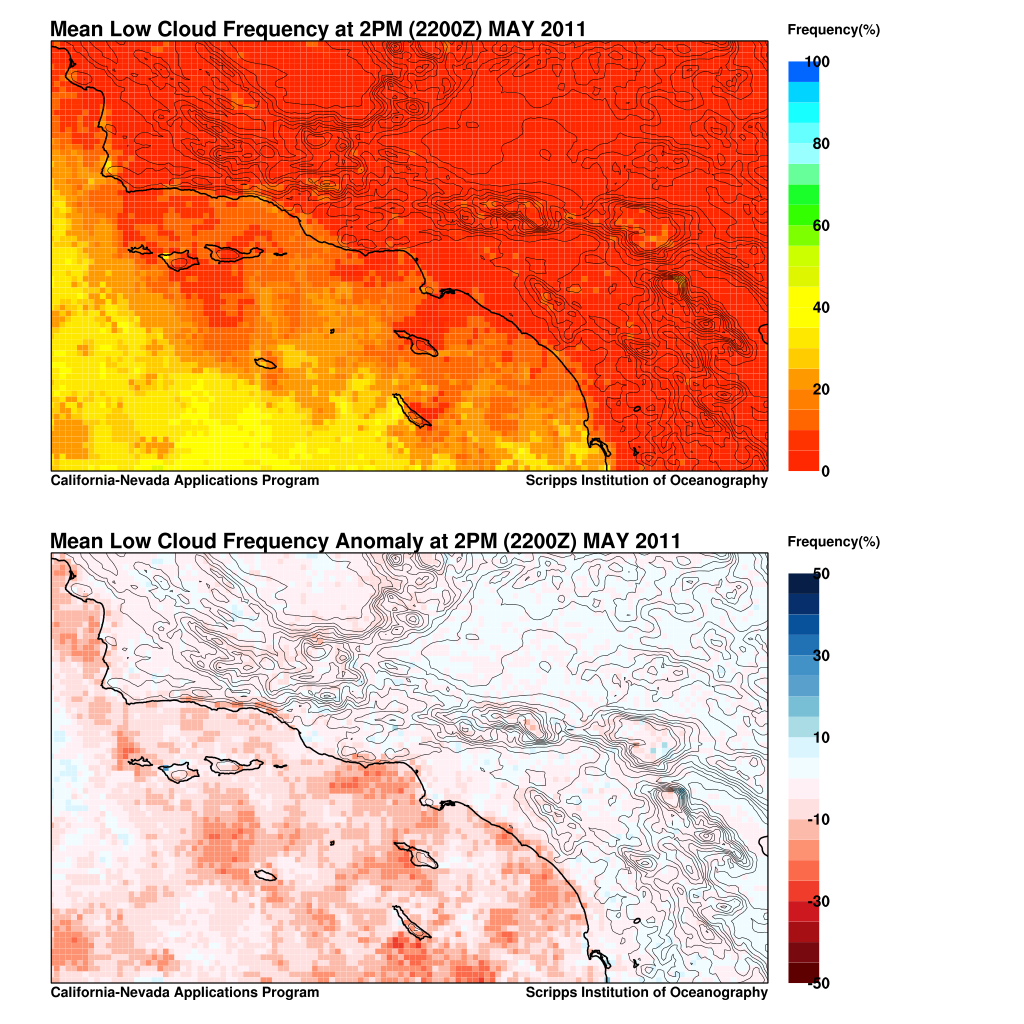
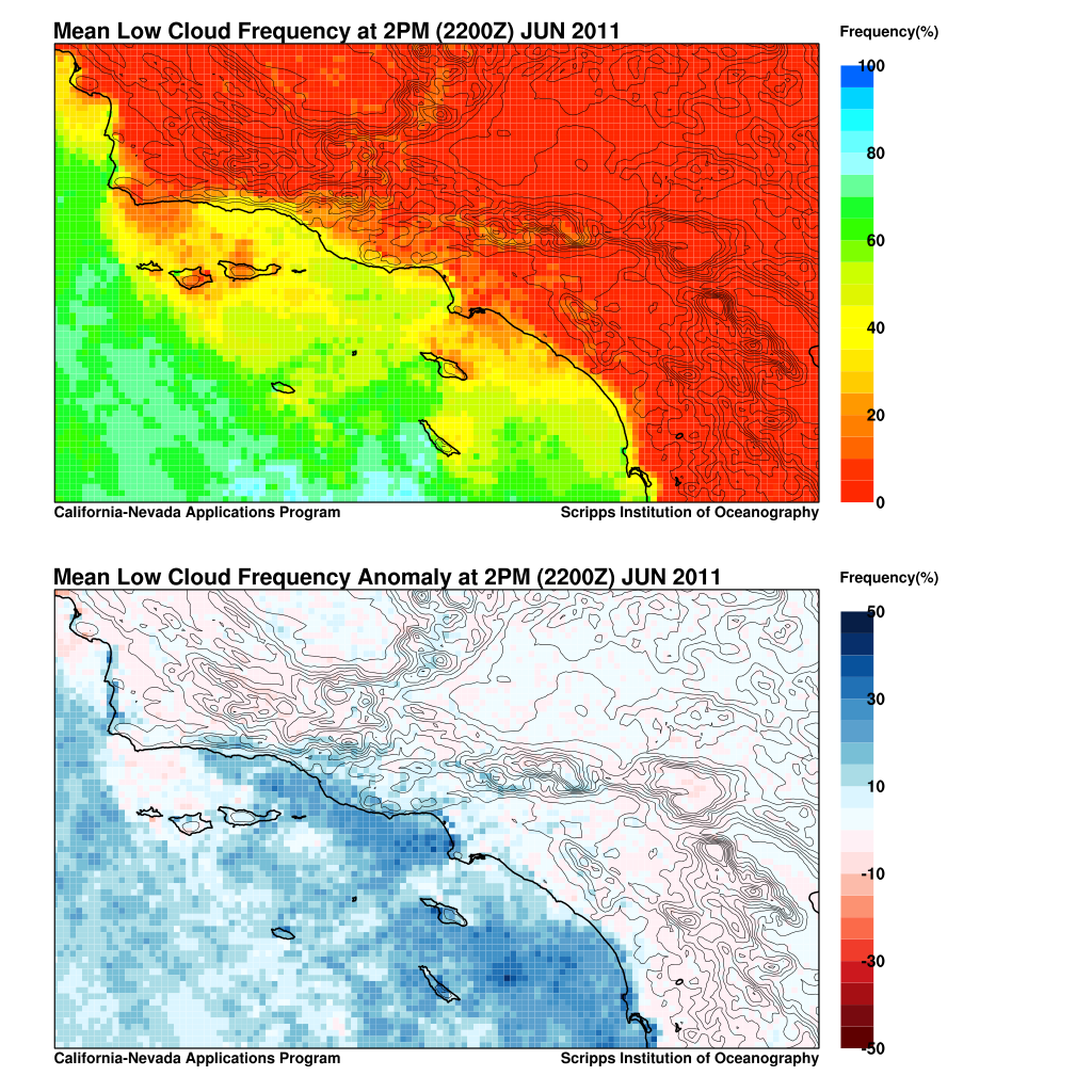
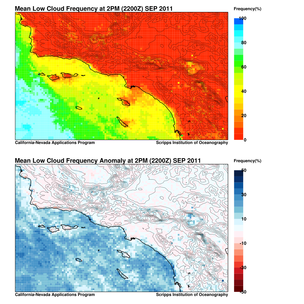
The table below contains links to maps of low cloud frequency over the Southern California Bight region. Maps showing monthly climatology of low cloud frequency based are based on the 1996-2008 period. Maps of low cloud frequency for individual months contain two plots; the top plot is the actual mean low cloud frequency for that month and the bottom plot is the difference from the long-term mean (anomaly). The bottom plot is helpful for determining if a given month was more or less cloudy than normal.
| Year | May | Jun | Jul | Aug | Sep |
|---|---|---|---|---|---|
| Climatology 1996-2008 |
7AM 2PM | 7AM 2PM | 7AM 2PM | 7AM 2PM | 7AM 2PM |
| 1996 | 7AM 2PM | 7AM 2PM | 7AM 2PM | 7AM 2PM | 7AM 2PM |
| 1997 | 7AM 2PM | 7AM 2PM | 7AM 2PM | 7AM 2PM | 7AM 2PM |
| 1998 | 7AM 2PM | 7AM 2PM | 7AM 2PM | 7AM 2PM | 7AM 2PM |
| 1999 | 7AM 2PM | 7AM 2PM | 7AM 2PM | 7AM 2PM | 7AM 2PM |
| 2000 | 7AM 2PM | 7AM 2PM | 7AM 2PM | 7AM 2PM | 7AM 2PM |
| 2001 | 7AM 2PM | 7AM 2PM | 7AM 2PM | 7AM 2PM | 7AM 2PM |
| 2002 | 7AM 2PM | 7AM 2PM | 7AM 2PM | 7AM 2PM | 7AM 2PM |
| 2003 | 7AM 2PM | 7AM 2PM | 7AM 2PM | 7AM 2PM | 7AM 2PM |
| 2004 | 7AM 2PM | 7AM 2PM | 7AM 2PM | 7AM 2PM | 7AM 2PM |
| 2005 | 7AM 2PM | 7AM 2PM | 7AM 2PM | 7AM 2PM | 7AM 2PM |
| 2006 | 7AM 2PM | 7AM 2PM | 7AM 2PM | 7AM 2PM | 7AM 2PM |
| 2007 | 7AM 2PM | 7AM 2PM | 7AM 2PM | 7AM 2PM | 7AM 2PM |
| 2008 | 7AM 2PM | 7AM 2PM | 7AM 2PM | 7AM 2PM | 7AM 2PM |
| 2009 | 7AM 2PM | 7AM 2PM | 7AM 2PM | 7AM 2PM | 7AM 2PM |
| 2010 | 7AM 2PM | 7AM 2PM | 7AM 2PM | 7AM 2PM | 7AM 2PM |
| 2011 | 7AM 2PM | 7AM 2PM | 7AM 2PM | 7AM 2PM | 7AM 2PM |