During December 1999, the cold sea surface temperature
anomalies (SSTAs) that characterize La Nina continued throughout the tropical
Pacific. The following figure shows the observed SSTAs (degrees C) over
the tropical Pacific durnig December 1999 (from the TAO/TRITON moorings).
The cold episode has strengthened during the past few
months. The average SSTAs over an area of the tropical Pacific called the
Nino region (5N-5S; 150W-90W) have continued to decrease and are similar
to the values observed in December 1998.
Since 1947 there have been 9 major La Nina events. These
occurred in the years:
1949/1950
1954/1955
1964/1965
1970/1971
1973/1974
1975/1976
1988/1989
1995/1996
1998/1999
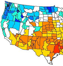
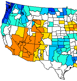
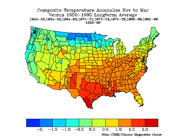
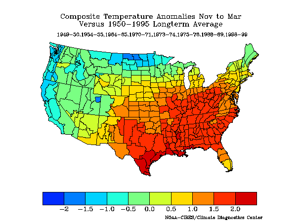
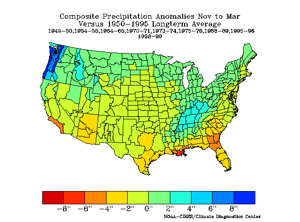
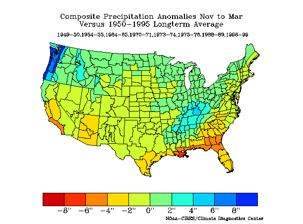
During these La Ninas, the United States has seen significant changes in normal precipitation and temperature patterns
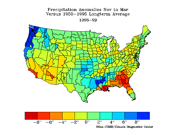
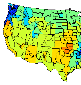
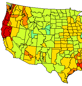
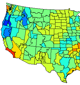
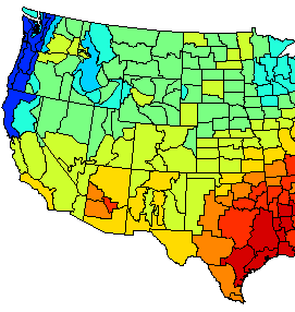
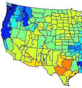
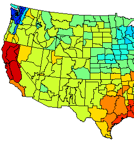
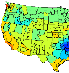
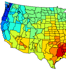
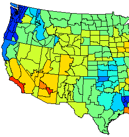
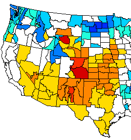
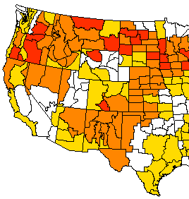
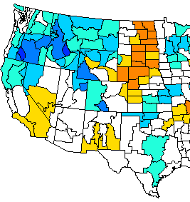
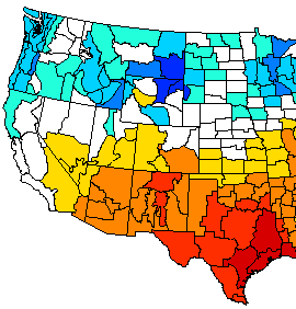
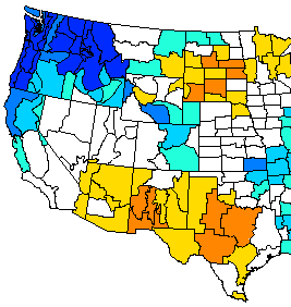
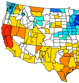
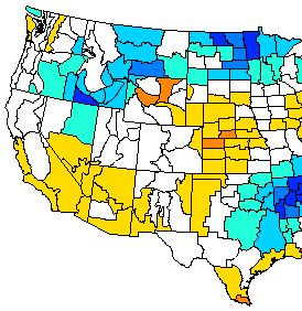
Precipitation Anomalies from November to March During La Nina Years Versus 1950-1995 Longterm Average
| 1949-1950
|
1954-1955
|
1964-1965
|
| 1970-1971
|
1973-1974
|
1975-1976
|
| 1988-1989
|
1995-1996
|
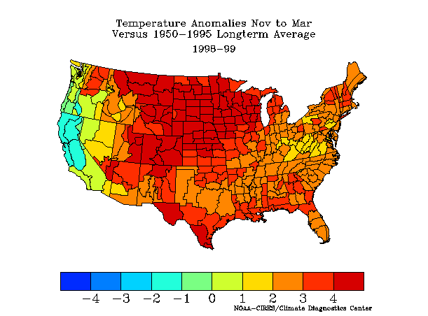
1998-1999
|
 |
| 1949-1950
|
1954-1955
|
1964-1965
|
| 1970-1971
|
1973-1974
|
1975-1976
|
| 1988-1989
|
1995-1996
|
1998-1999
|
 |
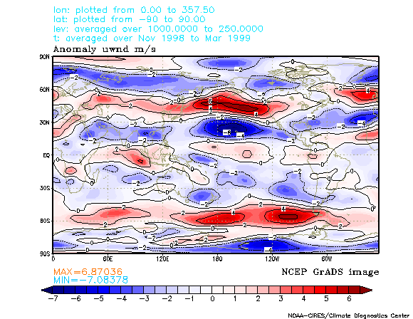
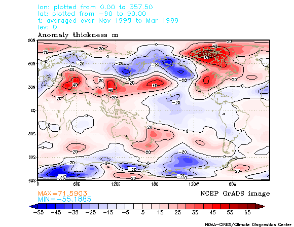
1998/1999 was a strong La Nina year