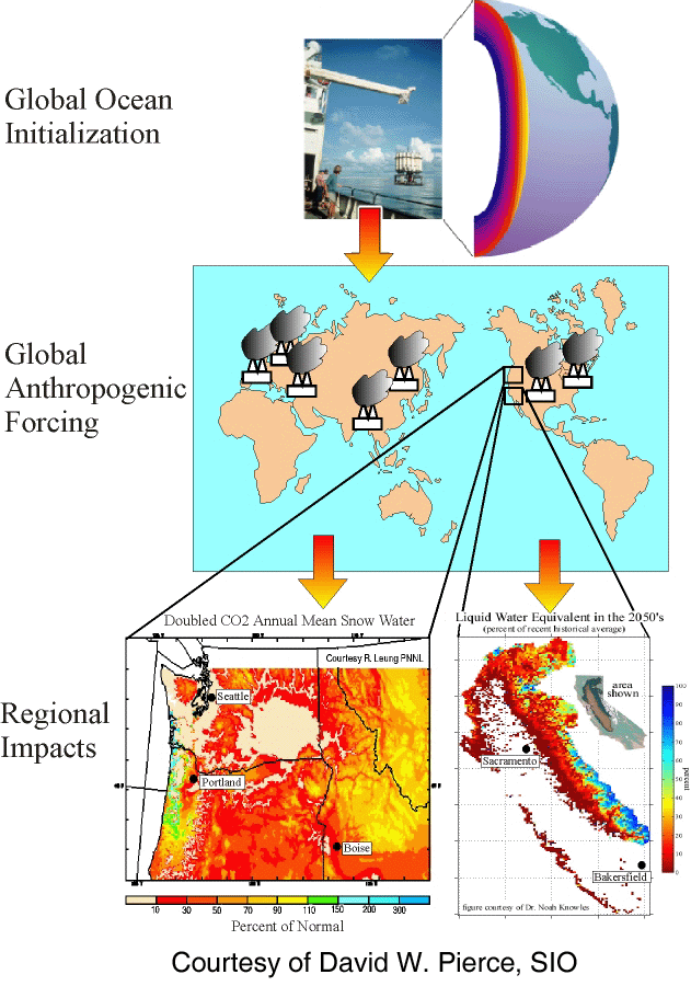
Project schematic. (Top) Observed ocean
state of the mid-1990s is (Middle) used to initialize CGCM
forced by BAU scenario. This gives data (precip, snow, temperature,
etc.) that is (Bottom) downscaled to 40km grid over the western US
for subsequent impact analysis. Impacts: The lower right panel shows the
large decrease in Sierra snow pack in 2050. The lower left panel
shows the large reduction in annual mean snow pack in the Pacific Northwest.
Previous slide
Contents
Next Slide